Dubno night lights from space
Night Light of Dubno (Rivne) from space (Ukraine) Src. Average luminocity for 10x10km area is 7.9342% and for 50x50km: 0.5316%.
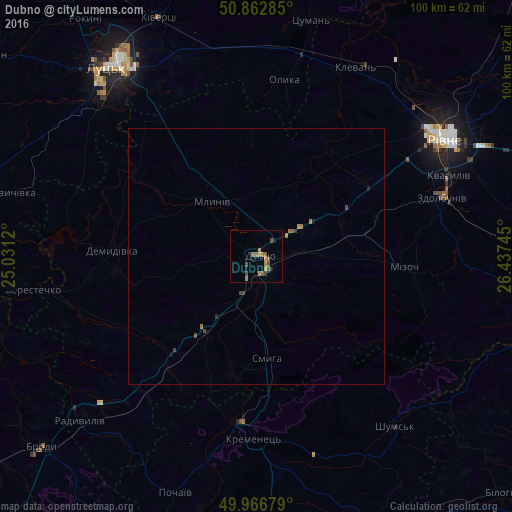
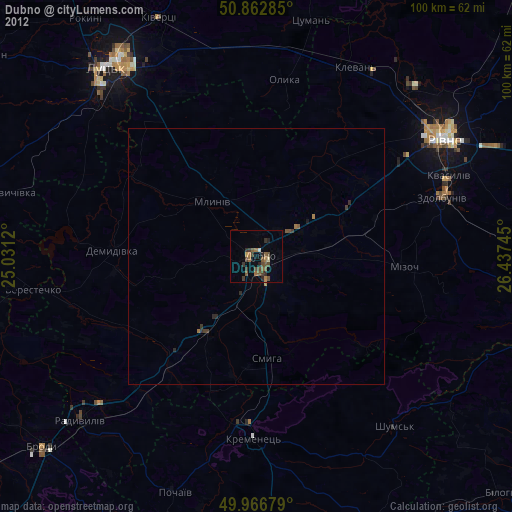
Analysis of Dubno night lights 2016
Square area 10x10 km:
 0%
0%90-99
0%80-89
0%70-79
1.4%60-69
4.2%50-59
2.24%40-49
2.1%30-39
0.7%20-29
0.7%10-19
0.84%0-9
87.82%Square area 50x50 km:
0%90-99
0%80-89
0%70-79
0.11%60-69
0.24%50-59
0.12%40-49
0.19%30-39
0.07%20-29
0.07%10-19
0.08%0-9
99.13%Clear (daylight) street map image can be seen on geolist.org.
Map coordinates:
50° 51' 46.3" North, 25° 1' 52.3" East
50° 25' 1" North, 25° 44' 3.6" East
49° 58' 0.4" North, 26° 26' 14.8" East
Some cities around Dubno sort by population:
• Rivne
41.7 km =25.9 mi,  56°
56°
• Lutsk
47.1 km =29.3 mi,  323°
323°
• Zdolbuniv
37.8 km =23.5 mi,  72°
72°
• Kremenets
35.6 km =22.1 mi,  181°
181°
• Kivertsi
50.3 km =31.3 mi,  337°
337°
• Radyvyliv
46.6 km =29 mi,  226°
226°
• Mlyniv
13.2 km =8.2 mi, 320°
• Pochaiv
48.5 km =30.1 mi,  199°
199°
709540 (p: 37,690)
Sources (retrieved 2019-11-25):
» Earth at Night: Flat Maps 2012, 2016