Krasyliv night lights from space
Night Light of Krasyliv (Khmelnytskyi) from space (Ukraine) Src. Average luminocity for 10x10km area is 2.1611% and for 50x50km: 1.0193%.
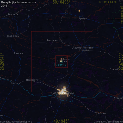
Analysis of Krasyliv night lights 2016
Square area 10x10 km:
 0%
0%90-99
0%80-89
0%70-79
0%60-69
0.56%50-59
0.56%40-49
1.54%30-39
0.7%20-29
1.12%10-19
0%0-9
95.52%Square area 50x50 km:
0.09%90-99
0.11%80-89
0.21%70-79
0.11%60-69
0.12%50-59
0.14%40-49
0.17%30-39
0.09%20-29
0.2%10-19
1.04%0-9
97.72%Clear (daylight) street map image can be seen on geolist.org.
Map coordinates:
50° 6' 17.9" North, 26° 16' 9.9" East
49° 39' 6.7" North, 26° 58' 21.1" East
49° 11' 40.2" North, 27° 40' 32.4" East
Some cities around Krasyliv sort by population:
• Khmelnytskyi
25.7 km =16 mi,  176°
176°
• Shepetivka
59.7 km =37.1 mi,  6°
6°
• Starokostiantyniv
20.3 km =12.6 mi,  54°
54°
• Izyaslav
53.1 km =33 mi,  348°
348°
• Letychiv
56.1 km =34.9 mi,  122°
122°
• Derazhnya
54.1 km =33.6 mi,  141°
141°
• Yarmolyntsi
52 km =32.3 mi,  190°
190°
• Stara Syniava
46.9 km =29.1 mi,  96°
96°
704492 (p: 19,815)
Sources (retrieved 2019-11-25):
» Earth at Night: Flat Maps 2012, 2016