Yarmolyntsi night lights from space
Night Light of Yarmolyntsi (Khmelnytskyi) from space (Ukraine) Src. Average luminocity for 10x10km area is 0% and for 50x50km: 0.7556%.
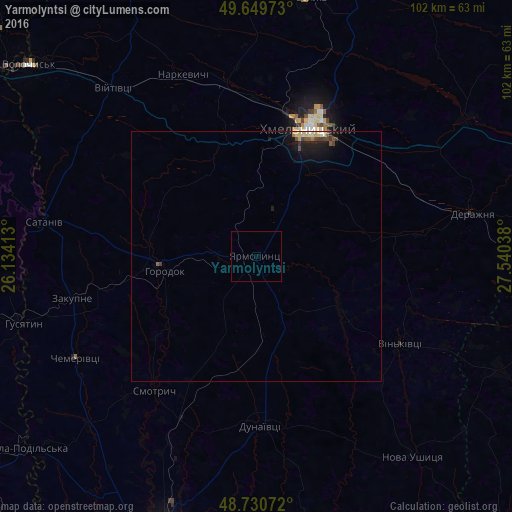
Analysis of Yarmolyntsi night lights 2016
Square area 10x10 km:
 0%
0%90-99
0%80-89
0%70-79
0%60-69
0%50-59
0%40-49
0%30-39
0%20-29
0%10-19
0%0-9
100%Square area 50x50 km:
0.02%90-99
0.12%80-89
0.18%70-79
0.03%60-69
0.07%50-59
0.09%40-49
0.16%30-39
0.18%20-29
0.11%10-19
0.8%0-9
98.26%Clear (daylight) street map image can be seen on geolist.org.
Map coordinates:
49° 38' 59" North, 26° 8' 2.9" East
49° 11' 32.5" North, 26° 50' 14.1" East
48° 43' 50.6" North, 27° 32' 25.4" East
Some cities around Yarmolyntsi sort by population:
• Khmelnytskyi
28 km =17.4 mi,  24°
24°
• Kamianets-Podilskyi
59.4 km =36.9 mi,  198°
198°
• Krasyliv
52 km =32.3 mi,  10°
10°
• Horodok
18.7 km =11.6 mi,  260°
260°
• Dunaivtsi
33.7 km =20.9 mi,  177°
177°
• Derazhnya
44.2 km =27.5 mi,  78°
78°
• Husiatyn
49.3 km =30.6 mi,  254°
254°
• Makiv
45.5 km =28.3 mi,  193°
193°
688440 (p: 8,583)
Sources (retrieved 2019-11-25):
» Earth at Night: Flat Maps 2012, 2016