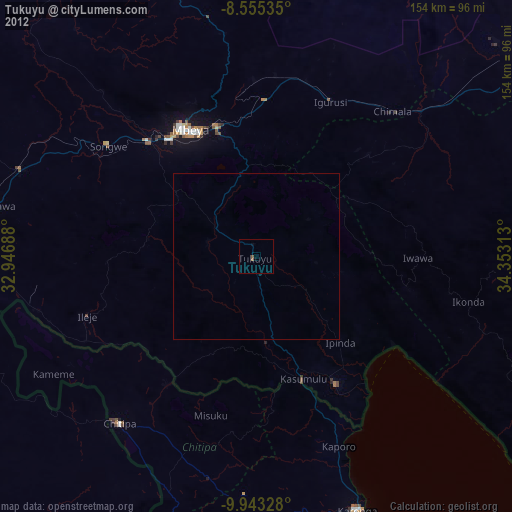
Tukuyu night lights from space
Night Light of Tukuyu (Mbeya) from space (Tanzania) Src. Average luminocity for 10x10km area is 1.3918% and for 50x50km: 0.0851%.
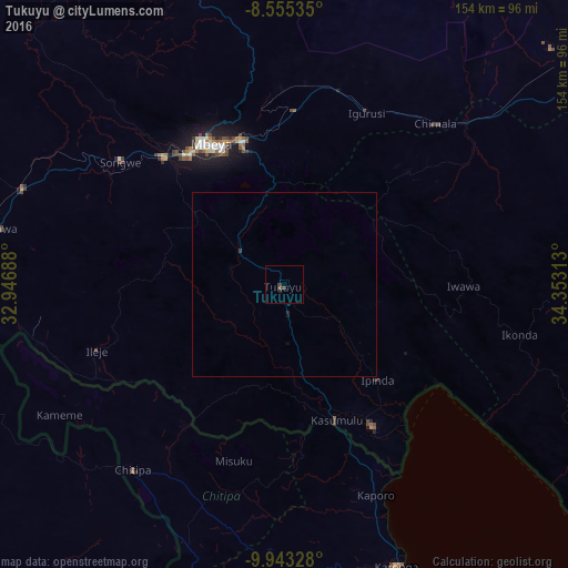
Analysis of Tukuyu night lights 2016
Square area 10x10 km:
100  0%
0%
90-99 0%
80-89 0%
70-79 0%
60-69 0%
50-59 0.43%
40-49 1.3%
30-39 0.87%
20-29 0.87%
10-19 0%
0-9 96.54%
0%90-99
0%80-89
0%70-79
0%60-69
0%50-59
0.43%40-49
1.3%30-39
0.87%20-29
0.87%10-19
0%0-9
96.54%Square area 50x50 km:
100 0%
90-99 0%
80-89 0%
70-79 0%
60-69 0%
50-59 0.02%
40-49 0.05%
30-39 0.07%
20-29 0.07%
10-19 0.05%
0-9 99.75%
0%90-99
0%80-89
0%70-79
0%60-69
0%50-59
0.02%40-49
0.05%30-39
0.07%20-29
0.07%10-19
0.05%0-9
99.75%Clear (daylight) street map image can be seen on geolist.org.
Map coordinates:
8° 33' 19.3" South, 32° 56' 48.8" East
9° 15' 0" South, 33° 39' 0" East
9° 56' 35.8" South, 34° 21' 11.3" East
Some cities around Tukuyu sort by population:
• Mbeya
44.7 km =27.8 mi,  330°
330°
• Katumba
4.1 km =2.5 mi,  296°
296°
• Kyela
43.1 km =26.8 mi,  149°
149°
• Kiwira
14.7 km =9.1 mi,  305°
305°
• Ipinda
37.8 km =23.5 mi,  133°
133°
• Masoko
14.4 km =8.9 mi, 130°
• Ulenje
35.4 km =22 mi,  5°
5°
• Kandete
19.9 km =12.4 mi,  55°
55°
149437 (p: 28,398)
Sources (retrieved 2019-11-25):
» Earth at Night: Flat Maps 2012, 2016