Mlowo night lights from space
Night Light of Mlowo (Songwe) from space (Tanzania) Src. Average luminocity for 10x10km area is 2.4913% and for 50x50km: 0.2923%.
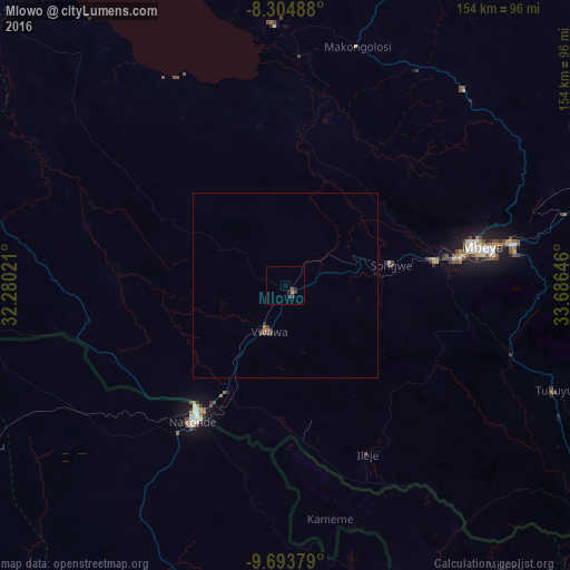
Analysis of Mlowo night lights 2016
Square area 10x10 km:
100  0%
0%
90-99 0%
80-89 0%
70-79 0.87%
60-69 0%
50-59 0.43%
40-49 1.3%
30-39 1.08%
20-29 2.16%
10-19 0.22%
0-9 93.94%
0%90-99
0%80-89
0%70-79
0.87%60-69
0%50-59
0.43%40-49
1.3%30-39
1.08%20-29
2.16%10-19
0.22%0-9
93.94%Square area 50x50 km:
100 0%
90-99 0%
80-89 0%
70-79 0.03%
60-69 0.09%
50-59 0.06%
40-49 0.15%
30-39 0.12%
20-29 0.14%
10-19 0.01%
0-9 99.39%
0%90-99
0%80-89
0%70-79
0.03%60-69
0.09%50-59
0.06%40-49
0.15%30-39
0.12%20-29
0.14%10-19
0.01%0-9
99.39%Clear (daylight) street map image can be seen on geolist.org.
Map coordinates:
8° 18' 17.6" South, 32° 16' 48.8" East
9° 0' 0" South, 32° 58' 60" East
9° 41' 37.6" South, 33° 41' 11.3" East
Some cities around Mlowo sort by population:
• Mbeya
52.4 km =32.6 mi,  77°
77°
• Katumba
74.2 km =46.1 mi,  110°
110°
• Vwawa
13.1 km =8.1 mi,  203°
203°
• Tunduma
41 km =25.5 mi,  215°
215°
• Kiwira
64.2 km =39.9 mi, 107°
• Itumba
49.6 km =30.8 mi,  153°
153°
• Ulenje
77.2 km =48 mi, 84°
• Nakonde, ZM
46.2 km =28.7 mi,  214°
214°
153352 (p: 18,737)
Sources (retrieved 2019-11-25):
» Earth at Night: Flat Maps 2012, 2016