Tunduma night lights from space
Night Light of Tunduma (Songwe) from space (Tanzania) Src. Average luminocity for 10x10km area is 27.855% and for 50x50km: 1.6016%.
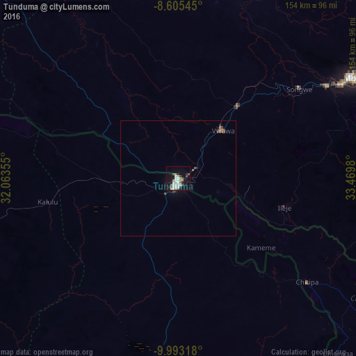
Analysis of Tunduma night lights 2016
Square area 10x10 km:
100  4.55%
4.55%
90-99 8.01%
80-89 1.52%
70-79 2.6%
60-69 4.55%
50-59 0.87%
40-49 3.25%
30-39 3.9%
20-29 2.6%
10-19 24.24%
0-9 43.94%
4.55%90-99
8.01%80-89
1.52%70-79
2.6%60-69
4.55%50-59
0.87%40-49
3.25%30-39
3.9%20-29
2.6%10-19
24.24%0-9
43.94%Square area 50x50 km:
100 0.18%
90-99 0.33%
80-89 0.06%
70-79 0.1%
60-69 0.34%
50-59 0.14%
40-49 0.26%
30-39 0.25%
20-29 0.21%
10-19 1.18%
0-9 96.94%
0.18%90-99
0.33%80-89
0.06%70-79
0.1%60-69
0.34%50-59
0.14%40-49
0.26%30-39
0.25%20-29
0.21%10-19
1.18%0-9
96.94%Clear (daylight) street map image can be seen on geolist.org.
Map coordinates:
8° 36' 19.6" South, 32° 3' 48.8" East
9° 18' 0" South, 32° 46' 0" East
9° 59' 35.4" South, 33° 28' 11.3" East
Some cities around Tunduma sort by population:
• Mbeya
87.2 km =54.2 mi,  59°
59°
• Katumba
93.6 km =58.2 mi,  85°
85°
• Vwawa
28.2 km =17.5 mi,  40°
40°
• Kiwira
86.2 km =53.6 mi,  80°
80°
• Mlowo
41 km =25.5 mi, 35°
• Itumba
47 km =29.2 mi,  103°
103°
• Nakonde, ZM
5.3 km =3.3 mi,  206°
206°
• Chitipa, MW
71 km =44.1 mi,  129°
129°
149402 (p: 36,556)
Sources (retrieved 2019-11-25):
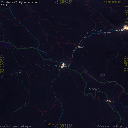
» Earth at Night: Flat Maps 2012, 2016