Paradise night lights from space
Night Light of Paradise (Tunapuna/Piarco) from space (Trinidad and Tobago) Src. Average luminocity for 10x10km area is 72.6508% and for 50x50km: 31.8357%.
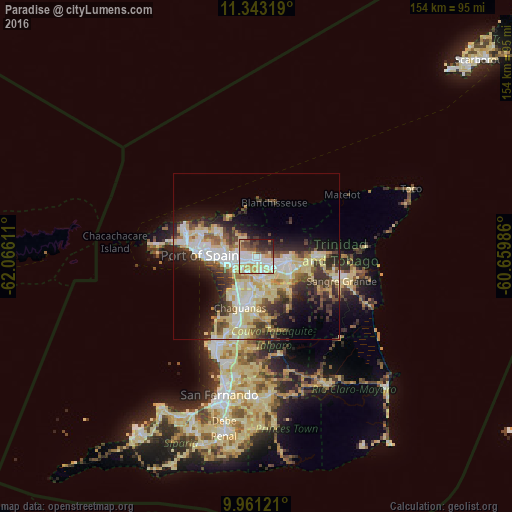
Analysis of Paradise night lights 2016
Square area 10x10 km:
 18.8%
18.8%90-99
17.36%80-89
17.36%70-79
8.88%60-69
3.31%50-59
8.47%40-49
8.68%30-39
6.61%20-29
9.09%10-19
1.45%0-9
0%Square area 50x50 km:
5.51%90-99
6.3%80-89
9.12%70-79
2.3%60-69
2.45%50-59
3.29%40-49
4.57%30-39
5.18%20-29
7.03%10-19
8.63%0-9
45.62%Clear (daylight) street map image can be seen on geolist.org.
Map coordinates:
11° 20' 35.5" North, 62° 3' 58" West
10° 39' 10.7" North, 61° 21' 46.7" West
9° 57' 40.4" North, 60° 39' 35.5" West
Some cities around Paradise sort by population:
• Chaguanas
16.3 km =10.1 mi,  201°
201°
• Port of Spain
17.1 km =10.6 mi,  275°
275°
• Arima
9 km =5.6 mi,  101°
101°
• Laventille
14.9 km =9.3 mi,  268°
268°
• Tunapuna
2.8 km =1.7 mi, 268°
• Arouca
4.1 km =2.5 mi,  131°
131°
• Petit Valley
20.8 km =12.9 mi, 284°
• Diego Martin
23.4 km =14.5 mi,  288°
288°
3573989 (p: 15,067)
Sources (retrieved 2019-11-25):
» Earth at Night: Flat Maps 2012, 2016