Diego Martin night lights from space
Night Light of Diego Martin from space (Trinidad and Tobago) Src. Average luminocity for 10x10km area is 53.2252% and for 50x50km: 17.7094%.
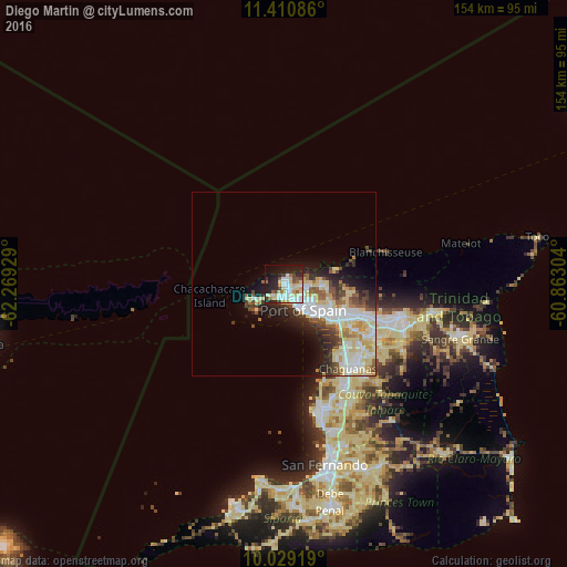
Analysis of Diego Martin night lights 2016
Square area 10x10 km:
 12.4%
12.4%90-99
12.81%80-89
12.6%70-79
2.69%60-69
3.93%50-59
4.13%40-49
6.2%30-39
2.48%20-29
16.53%10-19
20.04%0-9
6.2%Square area 50x50 km:
3.96%90-99
3.99%80-89
4.12%70-79
1.13%60-69
1.3%50-59
1.8%40-49
2.08%30-39
2.05%20-29
3.52%10-19
5.41%0-9
70.65%Clear (daylight) street map image can be seen on geolist.org.
Map coordinates:
11° 24' 39.1" North, 62° 16' 9.4" West
10° 43' 14.9" North, 61° 33' 58.2" West
10° 1' 45.1" North, 60° 51' 46.9" West
Some cities around Diego Martin sort by population:
• Chaguanas
28 km =17.4 mi,  144°
144°
• Port of Spain
7.9 km =4.9 mi, 139°
• Arima
32.4 km =20.1 mi,  106°
106°
• Laventille
10.8 km =6.7 mi, 137°
• Tunapuna
20.8 km =12.9 mi, 111°
• Paradise
23.4 km =14.5 mi, 108°
• Arouca
27.3 km =17 mi, 112°
• Petit Valley
3.1 km =1.9 mi, 138°
3574636 (p: 0)
Sources (retrieved 2019-11-25):
» Earth at Night: Flat Maps 2012, 2016