Laventille night lights from space
Night Light of Laventille (San Juan/Laventille) from space (Trinidad and Tobago) Src. Average luminocity for 10x10km area is 67.0455% and for 50x50km: 27.5545%.
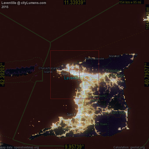
Analysis of Laventille night lights 2016
Square area 10x10 km:
 24.17%
90-99
20.45%80-89
6.61%70-79
3.1%60-69
2.48%50-59
5.79%40-49
7.64%30-39
7.44%20-29
11.36%10-19
8.68%0-9
2.27%Square area 50x50 km:
5.36%90-99
6.02%80-89
7.52%70-79
1.86%60-69
2.03%50-59
2.85%40-49
3.48%30-39
3.64%20-29
5.29%10-19
7.47%0-9
54.48%Clear (daylight) street map image can be seen on geolist.org.
Map coordinates:
11° 20' 21.8" North, 62° 12' 7.3" West
10° 38' 57" North, 61° 29' 56" West
9° 57' 26.6" North, 60° 47' 44.8" West
Some cities around Laventille sort by population:
• Chaguanas
17.3 km =10.7 mi,  148°
148°
• Port of Spain
2.9 km =1.8 mi,  311°
311°
• Arima
23.7 km =14.7 mi,  93°
93°
• Tunapuna
12 km =7.5 mi, 88°
• Paradise
14.9 km =9.3 mi, 88°
• Arouca
18.1 km =11.2 mi,  97°
97°
• Petit Valley
7.7 km =4.8 mi,  316°
316°
• Diego Martin
10.8 km =6.7 mi, 317°
3574309 (p: 21,000)
Sources (retrieved 2019-11-25):
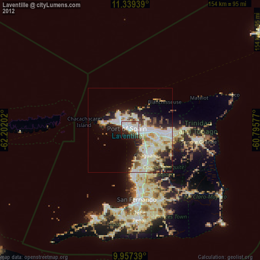
» Earth at Night: Flat Maps 2012, 2016