Tepecik night lights from space
Night Light of Tepecik (Istanbul) from space (Turkey) Src. Average luminocity for 10x10km area is 63.7279% and for 50x50km: 26.7144%.

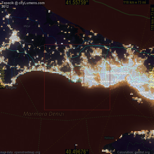
Analysis of Tepecik night lights 2016
Square area 10x10 km:
 12.76%
90-99
12.59%80-89
7.31%70-79
7.14%60-69
14.46%50-59
13.27%40-49
6.8%30-39
13.27%20-29
11.22%10-19
1.19%0-9
0%Square area 50x50 km:
7.12%90-99
5.18%80-89
2.05%70-79
2.7%60-69
3.64%50-59
4.05%40-49
2.03%30-39
3.26%20-29
8.33%10-19
11.39%0-9
50.26%Clear (daylight) street map image can be seen on geolist.org.
Map coordinates:
41° 33' 27.3" North, 27° 50' 48" East
41° 1' 45.5" North, 28° 32' 59.2" East
40° 29' 48.3" North, 29° 15' 10.5" East
Some cities around Tepecik sort by population:
• Esenyurt
10.7 km =6.6 mi,  91°
91°
• Büyükçekmece
3.1 km =1.9 mi,  107°
107°
• Beylikdüzü
9.2 km =5.7 mi,  124°
124°
• Mimarsinan
1.6 km =1 mi,  141°
141°
• Gürpınar
6.8 km =4.2 mi,  127°
127°
• Yakuplu
11.5 km =7.1 mi, 112°
• Kumburgaz
5.9 km =3.7 mi,  261°
261°
• Celâliye
11.3 km =7 mi,  282°
282°
738858 (p: 21,699)
Sources (retrieved 2019-11-25):
» Earth at Night: Flat Maps 2012, 2016