Esenyurt night lights from space
Night Light of Esenyurt (Istanbul) from space (Turkey) Src. Average luminocity for 10x10km area is 94.7211% and for 50x50km: 33.582%.
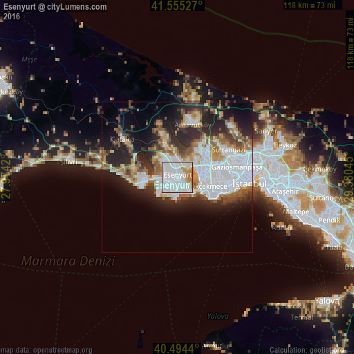
Analysis of Esenyurt night lights 2016
Square area 10x10 km:
 53.4%
53.4%90-99
30.95%80-89
0.68%70-79
4.93%60-69
9.69%50-59
0.34%40-49
0%30-39
0%20-29
0%10-19
0%0-9
0%Square area 50x50 km:
11.62%90-99
6.11%80-89
2.27%70-79
2.91%60-69
4.19%50-59
4.47%40-49
2.62%30-39
3.79%20-29
8.93%10-19
11.26%0-9
41.83%Clear (daylight) street map image can be seen on geolist.org.
Map coordinates:
41° 33' 19" North, 27° 58' 27.1" East
41° 1' 37.1" North, 28° 40' 38.4" East
40° 29' 39.8" North, 29° 22' 49.6" East
Some cities around Esenyurt sort by population:
• Bağcılar
15.1 km =9.4 mi,  84°
84°
• Başakşehir
12.8 km =8 mi,  54°
54°
• Büyükçekmece
7.8 km =4.8 mi,  264°
264°
• Beylikdüzü
5.9 km =3.7 mi,  212°
212°
• Mimarsinan
9.7 km =6 mi, 264°
• Gürpınar
6.5 km =4 mi,  234°
234°
• Yakuplu
4.2 km =2.6 mi,  181°
181°
• Tepecik
10.7 km =6.6 mi,  271°
271°
747323 (p: 211,330)
Sources (retrieved 2019-11-25):
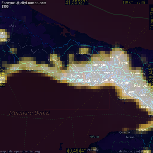
» NASA, Earths city lights 1995
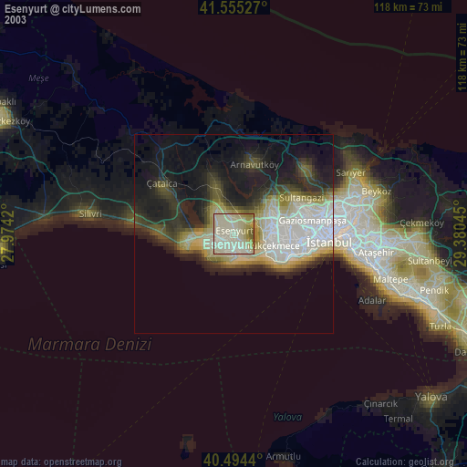
» NASA city lights 2003
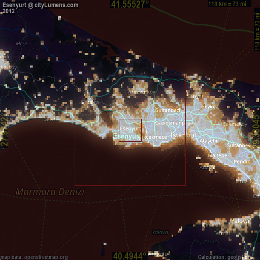
» Earth at Night: Flat Maps 2012, 2016