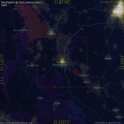
Seydişehir night lights from space
Night Light of Seydişehir (Konya) from space (Turkey) Src. Average luminocity for 10x10km area is 34.6153% and for 50x50km: 4.1541%.
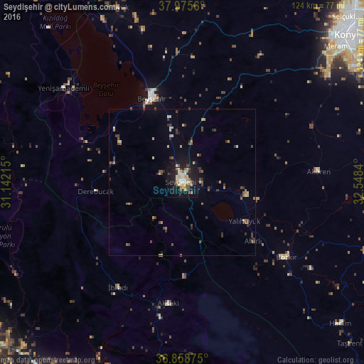


Analysis of Seydişehir night lights 2016
Square area 10x10 km:
 3.9%
3.9%90-99
6.66%80-89
5.68%70-79
6.66%60-69
3.41%50-59
2.92%40-49
4.87%30-39
1.3%20-29
6.98%10-19
39.29%0-9
18.34%Square area 50x50 km:
0.17%90-99
0.6%80-89
0.54%70-79
0.56%60-69
0.48%50-59
0.63%40-49
0.8%30-39
0.99%20-29
0.69%10-19
2.55%0-9
91.99%Clear (daylight) street map image can be seen on geolist.org.
Map coordinates:
37° 58' 32.2" North, 31° 8' 31.7" East
37° 25' 9.3" North, 31° 50' 43" East
36° 51' 31.5" North, 32° 32' 54.2" East
Some cities around Seydişehir sort by population:
• Beyşehir
30.6 km =19 mi,  339°
339°
• Akseki
41.5 km =25.8 mi,  186°
186°
• Hüyük
63.3 km =39.3 mi, 339°
• Bozkır
43.8 km =27.2 mi,  125°
125°
• İbradı
41.9 km =26 mi,  211°
211°
• Yalıhüyük
25 km =15.5 mi,  121°
121°
• Yenişarbademli
51.6 km =32.1 mi,  308°
308°
• Derebucak
29.8 km =18.5 mi,  264°
264°
301010 (p: 51,089)
Sources (retrieved 2019-11-25):
» NASA, Earths city lights 1995
» NASA city lights 2003
» Earth at Night: Flat Maps 2012, 2016