Derebucak night lights from space
Night Light of Derebucak (Konya) from space (Turkey) Src. Average luminocity for 10x10km area is 1.6445% and for 50x50km: 1.2904%.
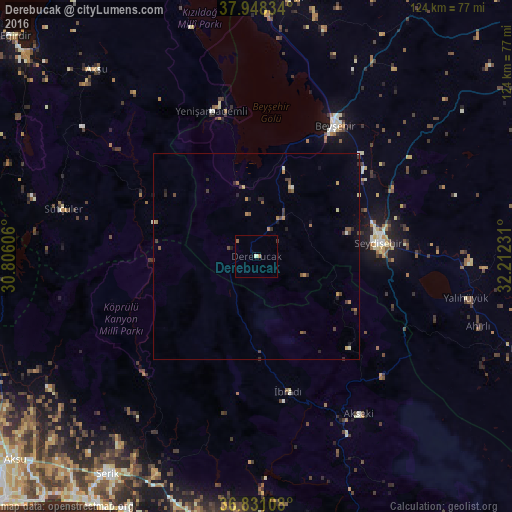
Analysis of Derebucak night lights 2016
Square area 10x10 km:
 0%
0%90-99
0.49%80-89
0.16%70-79
0%60-69
1.14%50-59
0.16%40-49
0%30-39
0.32%20-29
0%10-19
0%0-9
97.73%Square area 50x50 km:
0.01%90-99
0.13%80-89
0.14%70-79
0.18%60-69
0.26%50-59
0.21%40-49
0.37%30-39
0.35%20-29
0.27%10-19
0.24%0-9
97.84%Clear (daylight) street map image can be seen on geolist.org.
Map coordinates:
37° 56' 54" North, 30° 48' 21.8" East
37° 23' 30.4" North, 31° 30' 33" East
36° 49' 51.9" North, 32° 12' 44.3" East
Some cities around Derebucak sort by population:
• Seydişehir
29.8 km =18.5 mi,  84°
84°
• Beyşehir
37 km =23 mi,  30°
30°
• Serik
64.1 km =39.8 mi,  214°
214°
• Akseki
45.5 km =28.3 mi,  146°
146°
• Hüyük
63 km =39.1 mi,  7°
7°
• İbradı
33.7 km =20.9 mi,  166°
166°
• Yalıhüyük
51.9 km =32.2 mi,  101°
101°
• Yenişarbademli
36.8 km =22.9 mi,  342°
342°
317049 (p: 5,035)
Sources (retrieved 2019-11-25):
» Earth at Night: Flat Maps 2012, 2016