Bozkır night lights from space
Night Light of Bozkır (Konya) from space (Turkey) Src. Average luminocity for 10x10km area is 10.5442% and for 50x50km: 1.9896%.
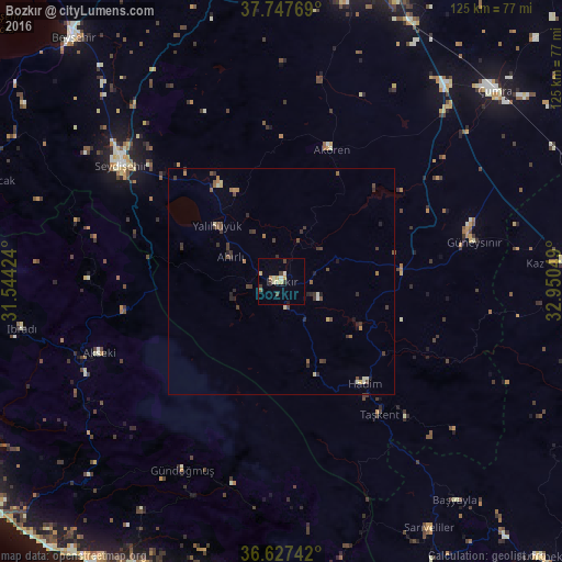
Analysis of Bozkır night lights 2016
Square area 10x10 km:
 0.51%
0.51%90-99
1.87%80-89
1.7%70-79
2.72%60-69
0%50-59
0.68%40-49
1.87%30-39
2.21%20-29
0.17%10-19
0.51%0-9
87.76%Square area 50x50 km:
0.02%90-99
0.25%80-89
0.25%70-79
0.17%60-69
0.25%50-59
0.33%40-49
0.48%30-39
0.85%20-29
0.45%10-19
0.23%0-9
96.71%Clear (daylight) street map image can be seen on geolist.org.
Map coordinates:
37° 44' 51.7" North, 31° 32' 39.3" East
37° 11' 22.7" North, 32° 14' 50.5" East
36° 37' 38.7" North, 32° 57' 1.8" East
Some cities around Bozkır sort by population:
• Seydişehir
43.8 km =27.2 mi,  305°
305°
• Hadim
29.1 km =18.1 mi,  140°
140°
• Taşkent
36.6 km =22.7 mi, 143°
• Akseki
43.5 km =27 mi,  248°
248°
• İbradı
58.4 km =36.3 mi,  259°
259°
• Yalıhüyük
18.9 km =11.7 mi, 310°
• Eksere
47.3 km =29.4 mi,  207°
207°
• Başyayla
61.9 km =38.5 mi, 141°
320621 (p: 10,958)
Sources (retrieved 2019-11-25):
» Earth at Night: Flat Maps 2012, 2016