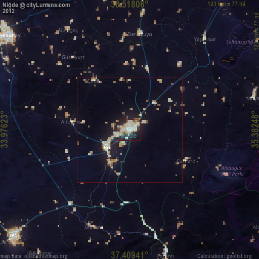
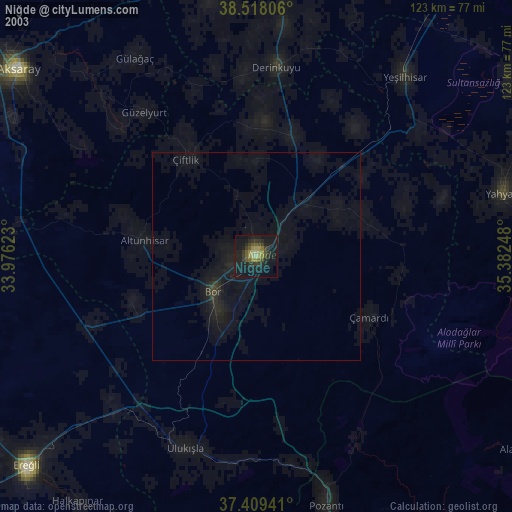
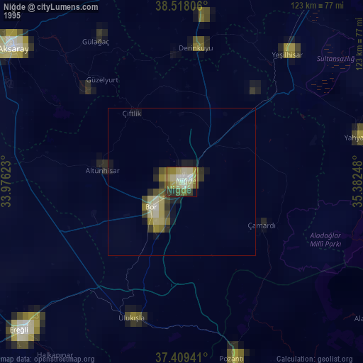
Niğde night lights from space
Night Light of Niğde from space (Turkey) Src. Average luminocity for 10x10km area is 58.3052% and for 50x50km: 10.4241%.
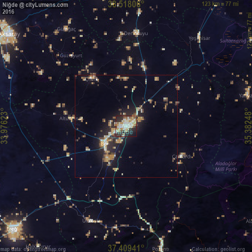
Analysis of Niğde night lights 2016
Square area 10x10 km:
 8.12%
8.12%90-99
19.97%80-89
8.93%70-79
8.12%60-69
5.36%50-59
3.25%40-49
5.84%30-39
8.12%20-29
21.92%10-19
9.09%0-9
1.3%Square area 50x50 km:
0.5%90-99
1.95%80-89
1.33%70-79
2.06%60-69
0.99%50-59
1.13%40-49
1.64%30-39
1.54%20-29
3.6%10-19
6.09%0-9
79.17%Clear (daylight) street map image can be seen on geolist.org.
Map coordinates:
38° 31' 5" North, 33° 58' 34.4" East
37° 57' 57" North, 34° 40' 45.7" East
37° 24' 33.9" North, 35° 22' 56.9" East
Some cities around Niğde sort by population:
• Aksaray
72.9 km =45.3 mi,  308°
308°
• Nevşehir
73.3 km =45.5 mi,  2°
2°
• Bor
13.5 km =8.4 mi,  231°
231°
• Yahyalı
61.3 km =38.1 mi,  75°
75°
• Yeşilhisar
55.9 km =34.7 mi,  39°
39°
• Derinkuyu
45.8 km =28.5 mi,  6°
6°
• Pozantı
62.2 km =38.6 mi,  164°
164°
• Acıgöl
66.7 km =41.4 mi,  347°
347°
303827 (p: 91,039)
Sources (retrieved 2019-11-25):
» NASA, Earths city lights 1995
» NASA city lights 2003
» Earth at Night: Flat Maps 2012, 2016