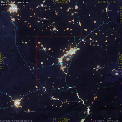
Bor night lights from space
Night Light of Bor (Niğde) from space (Turkey) Src. Average luminocity for 10x10km area is 39.1899% and for 50x50km: 9.7816%.
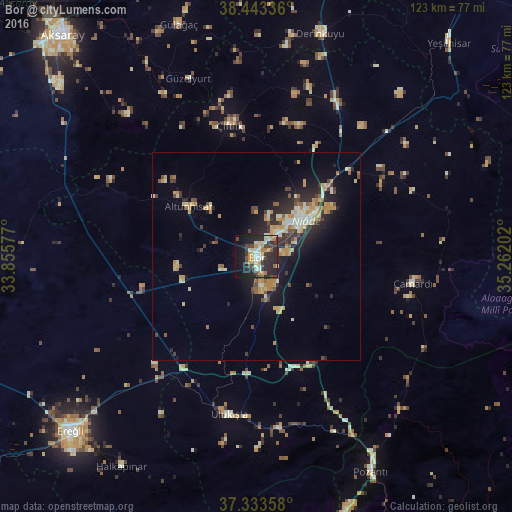
Analysis of Bor night lights 2016
Square area 10x10 km:
100  2.92%
2.92%
90-99 8.77%
80-89 6.01%
70-79 6.17%
60-69 3.25%
50-59 2.11%
40-49 6.66%
30-39 6.98%
20-29 25.16%
10-19 20.62%
0-9 11.36%
2.92%90-99
8.77%80-89
6.01%70-79
6.17%60-69
3.25%50-59
2.11%40-49
6.66%30-39
6.98%20-29
25.16%10-19
20.62%0-9
11.36%Square area 50x50 km:
100 0.5%
90-99 1.8%
80-89 1.41%
70-79 1.97%
60-69 0.97%
50-59 0.76%
40-49 1.39%
30-39 1.33%
20-29 3.64%
10-19 6.07%
0-9 80.15%
0.5%90-99
1.8%80-89
1.41%70-79
1.97%60-69
0.97%50-59
0.76%40-49
1.39%30-39
1.33%20-29
3.64%10-19
6.07%0-9
80.15%Clear (daylight) street map image can be seen on geolist.org.
Map coordinates:
38° 26' 36.1" North, 33° 51' 20.8" East
37° 53' 26" North, 34° 33' 32" East
37° 20' 0.9" North, 35° 15' 43.3" East
Some cities around Bor sort by population:
• Aksaray
71.1 km =44.2 mi,  318°
318°
• Ereğli
61.6 km =38.3 mi,  227°
227°
• Niğde
13.5 km =8.4 mi,  51°
51°
• Yeşilhisar
69.2 km =43 mi,  42°
42°
• Derinkuyu
56 km =34.8 mi,  15°
15°
• Pozantı
58.4 km =36.3 mi,  151°
151°
• Emirgazi
63.3 km =39.3 mi,  271°
271°
• Acıgöl
73.5 km =45.7 mi,  356°
356°
320871 (p: 32,435)
Sources (retrieved 2019-11-25):
» Earth at Night: Flat Maps 2012, 2016