İpsala night lights from space
Night Light of İpsala (Edirne) from space (Turkey) Src. Average luminocity for 10x10km area is 13.3129% and for 50x50km: 3.9886%.
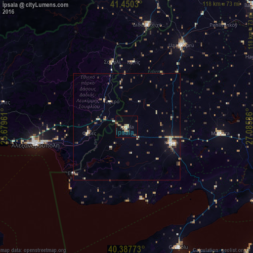
Analysis of İpsala night lights 2016
Square area 10x10 km:
 0%
0%90-99
1.7%80-89
1.87%70-79
1.7%60-69
3.74%50-59
1.7%40-49
2.21%30-39
1.36%20-29
1.19%10-19
2.38%0-9
82.14%Square area 50x50 km:
0.12%90-99
0.66%80-89
0.45%70-79
0.48%60-69
0.71%50-59
0.61%40-49
0.75%30-39
0.54%20-29
0.69%10-19
1.71%0-9
93.28%Clear (daylight) street map image can be seen on geolist.org.
Map coordinates:
41° 27' 1.1" North, 25° 40' 46.6" East
40° 55' 16.1" North, 26° 22' 57.8" East
40° 23' 15.8" North, 27° 5' 9.1" East
Some cities around İpsala sort by population:
• Alexandroupoli, GR
43.3 km =26.9 mi,  259°
259°
• Keşan
22 km =13.7 mi,  109°
109°
• Uzunköprü
46.1 km =28.6 mi,  33°
33°
• Malkara
43.7 km =27.2 mi,  94°
94°
• Gelibolu
61.8 km =38.4 mi,  156°
156°
• Orestiáda, GR
65.9 km =40.9 mi,  10°
10°
• Didymóteicho, GR
48.4 km =30.1 mi, 11°
• Féres, GR
18 km =11.2 mi, 259°
745148 (p: 8,060)
Sources (retrieved 2019-11-25):
» Earth at Night: Flat Maps 2012, 2016