Serik night lights from space
Night Light of Serik (Antalya) from space (Turkey) Src. Average luminocity for 10x10km area is 57.4432% and for 50x50km: 20.0016%.
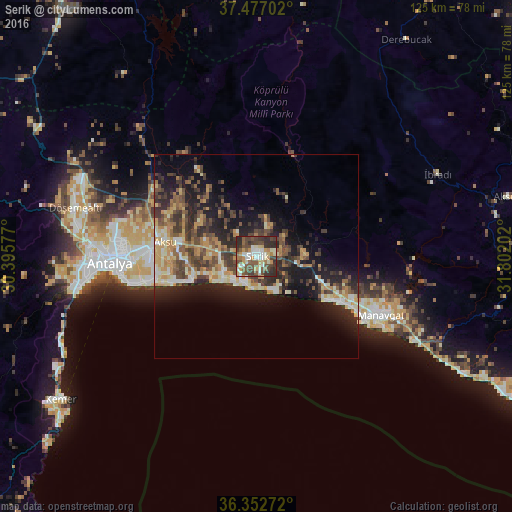
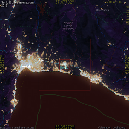
Analysis of Serik night lights 2016
Square area 10x10 km:
100  5.84%
5.84%
90-99 12.99%
80-89 6.98%
70-79 10.06%
60-69 4.71%
50-59 10.88%
40-49 18.18%
30-39 12.18%
20-29 18.18%
10-19 0%
0-9 0%
5.84%90-99
12.99%80-89
6.98%70-79
10.06%60-69
4.71%50-59
10.88%40-49
18.18%30-39
12.18%20-29
18.18%10-19
0%0-9
0%Square area 50x50 km:
100 1.19%
90-99 3.41%
80-89 2.53%
70-79 3.51%
60-69 2.43%
50-59 3.09%
40-49 4.46%
30-39 4.71%
20-29 6.79%
10-19 11.32%
0-9 56.55%
1.19%90-99
3.41%80-89
2.53%70-79
3.51%60-69
2.43%50-59
3.09%40-49
4.46%30-39
4.71%20-29
6.79%10-19
11.32%0-9
56.55%Clear (daylight) street map image can be seen on geolist.org.
Map coordinates:
37° 28' 37.3" North, 30° 23' 44.8" East
36° 55' 1" North, 31° 5' 56" East
36° 21' 9.8" North, 31° 48' 7.3" East
Some cities around Serik sort by population:
• Antalya
35.9 km =22.3 mi,  268°
268°
• Muratpaşa
29.8 km =18.5 mi,  264°
264°
• Manavgat
33.9 km =21.1 mi,  115°
115°
• Belek
7.1 km =4.4 mi,  212°
212°
• Kemer
59.7 km =37.1 mi,  233°
233°
• Side
30.7 km =19.1 mi, 122°
• İbradı
48.7 km =30.3 mi,  65°
65°
• Göynük
56.6 km =35.2 mi,  239°
239°
301101 (p: 36,925)
Sources (retrieved 2019-11-25):
» Earth at Night: Flat Maps 2012, 2016