Beytüşşebap night lights from space
Night Light of Beytüşşebap (Şırnak) from space (Turkey) Src. Average luminocity for 10x10km area is 4.9237% and for 50x50km: 1.0047%.
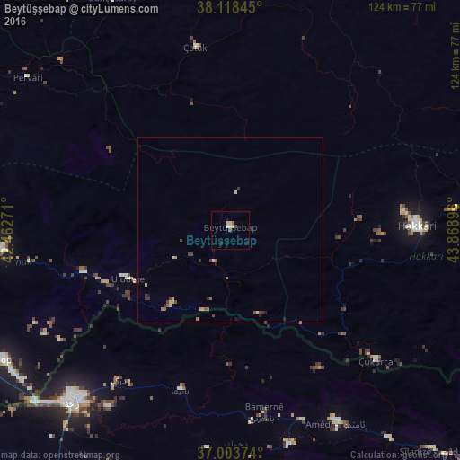
Analysis of Beytüşşebap night lights 2016
Square area 10x10 km:
 0.81%
0.81%90-99
0.49%80-89
1.95%70-79
0%60-69
0.49%50-59
0.16%40-49
0.97%30-39
0.32%20-29
0%10-19
1.3%0-9
93.51%Square area 50x50 km:
0.03%90-99
0.07%80-89
0.28%70-79
0.09%60-69
0.16%50-59
0.12%40-49
0.25%30-39
0.3%20-29
0.11%10-19
0.15%0-9
98.43%Clear (daylight) street map image can be seen on geolist.org.
Map coordinates:
38° 7' 6.4" North, 42° 27' 45.8" East
37° 33' 47.4" North, 43° 9' 57" East
37° 0' 13.5" North, 43° 52' 8.3" East
Some cities around Beytüşşebap sort by population:
• Zaxo, IQ
62.6 km =38.9 mi,  222°
222°
• Hakkâri
50.7 km =31.5 mi,  88°
88°
• Silopi
71.5 km =44.4 mi,  240°
240°
• Şırnak
63 km =39.1 mi,  265°
265°
• Batifa, IQ
45.3 km =28.1 mi,  197°
197°
• Çukurca
52.8 km =32.8 mi,  131°
131°
• Uludere
30.8 km =19.1 mi, 243°
• Pervari
68.2 km =42.4 mi,  307°
307°
321184 (p: 8,161)
Sources (retrieved 2019-11-25):
» Earth at Night: Flat Maps 2012, 2016