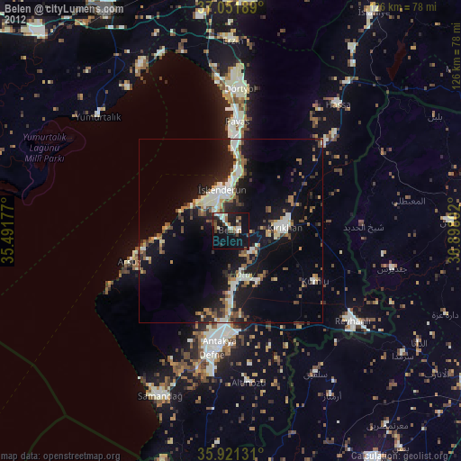
Belen night lights from space
Night Light of Belen (Hatay) from space (Turkey) Src. Average luminocity for 10x10km area is 31.8333% and for 50x50km: 17.2758%.
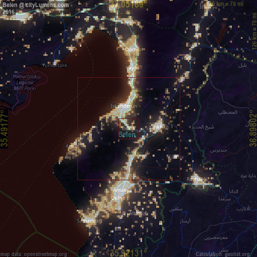
Analysis of Belen night lights 2016
Square area 10x10 km:
 1.1%
1.1%90-99
5.13%80-89
8.97%70-79
1.65%60-69
0.92%50-59
4.76%40-49
6.78%30-39
4.95%20-29
11.17%10-19
41.58%0-9
13%Square area 50x50 km:
1.13%90-99
2.89%80-89
2.71%70-79
2.27%60-69
1.16%50-59
1.92%40-49
3.8%30-39
2.99%20-29
6.07%10-19
14.98%0-9
60.07%Clear (daylight) street map image can be seen on geolist.org.
Map coordinates:
37° 3' 6.8" North, 35° 29' 30.4" East
36° 29' 19.2" North, 36° 11' 41.6" East
35° 55' 16.7" North, 36° 53' 52.9" East
Some cities around Belen sort by population:
• Antakya
31.5 km =19.6 mi,  186°
186°
• İskenderun
11.1 km =6.9 mi,  350°
350°
• Kırıkhan
14.6 km =9.1 mi,  85°
85°
• Dörtyol
39.1 km =24.3 mi,  4°
4°
• Denizciler
17 km =10.6 mi,  5°
5°
• Serinyol
14.2 km =8.8 mi,  173°
173°
• Kastal
27.1 km =16.8 mi, 171°
• Dursunlu
35.9 km =22.3 mi, 185°
321572 (p: 20,113)
Sources (retrieved 2019-11-25):
» Earth at Night: Flat Maps 2012, 2016