Kırıkhan night lights from space
Night Light of Kırıkhan (Hatay) from space (Turkey) Src. Average luminocity for 10x10km area is 42.2253% and for 50x50km: 16.6564%.
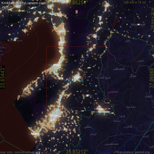
Analysis of Kırıkhan night lights 2016
Square area 10x10 km:
 6.23%
6.23%90-99
9.71%80-89
7.69%70-79
2.75%60-69
4.03%50-59
2.38%40-49
6.59%30-39
4.4%20-29
15.38%10-19
39.19%0-9
1.65%Square area 50x50 km:
1.18%90-99
2.85%80-89
2.64%70-79
1.81%60-69
1.12%50-59
1.79%40-49
3.55%30-39
3.2%20-29
6.26%10-19
14.25%0-9
61.36%Clear (daylight) street map image can be seen on geolist.org.
Map coordinates:
37° 3' 45.1" North, 35° 39' 15.9" East
36° 29' 57.8" North, 36° 21' 27.2" East
35° 55' 55.6" North, 37° 3' 38.4" East
Some cities around Kırıkhan sort by population:
• Antakya
37.2 km =23.1 mi,  208°
208°
• İskenderun
19.1 km =11.9 mi,  300°
300°
• Reyhanlı
31.9 km =19.8 mi,  143°
143°
• Belen
14.6 km =9.1 mi,  265°
265°
• Denizciler
20.3 km =12.6 mi,  320°
320°
• Serinyol
20 km =12.4 mi,  220°
220°
• Hassa
36.3 km =22.6 mi,  23°
23°
• Kastal
29.9 km =18.6 mi,  200°
200°
307657 (p: 60,916)
Sources (retrieved 2019-11-25):
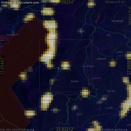
» NASA, Earths city lights 1995
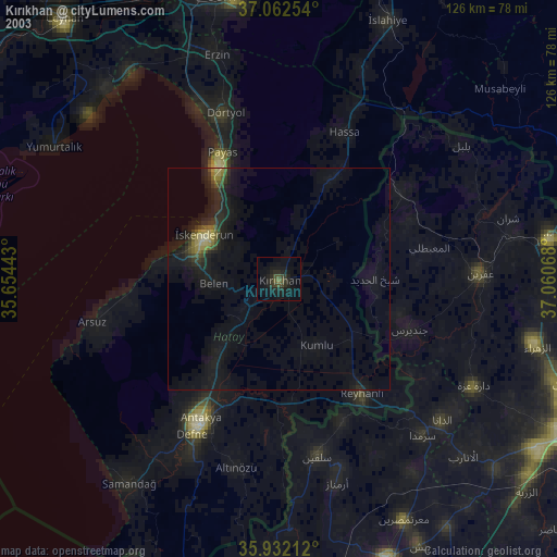
» NASA city lights 2003
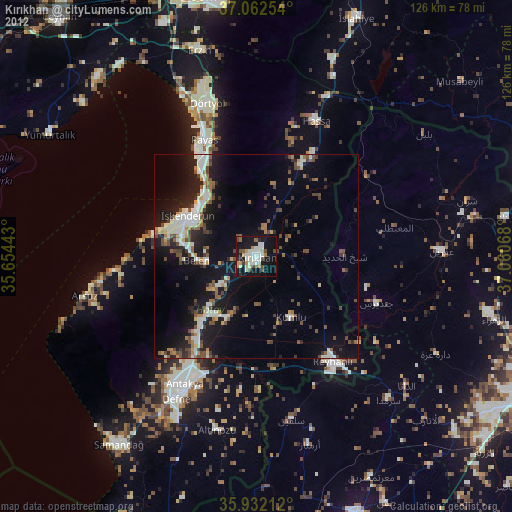
» Earth at Night: Flat Maps 2012, 2016