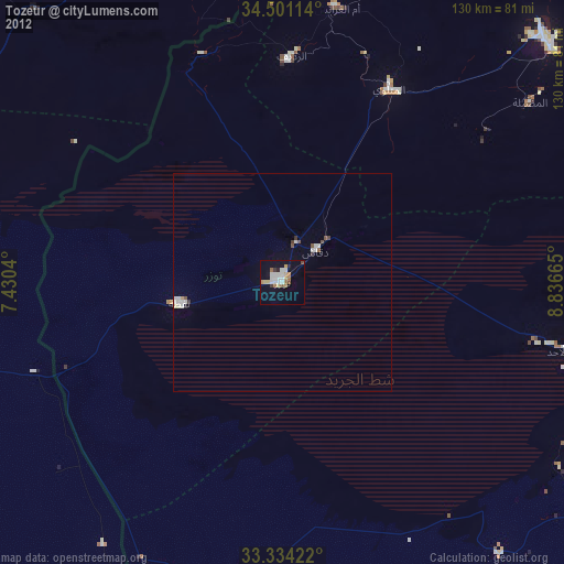
Tozeur night lights from space
Night Light of Tozeur (Tawzar) from space (Tunisia) Src. Average luminocity for 10x10km area is 21.4178% and for 50x50km: 1.8641%.
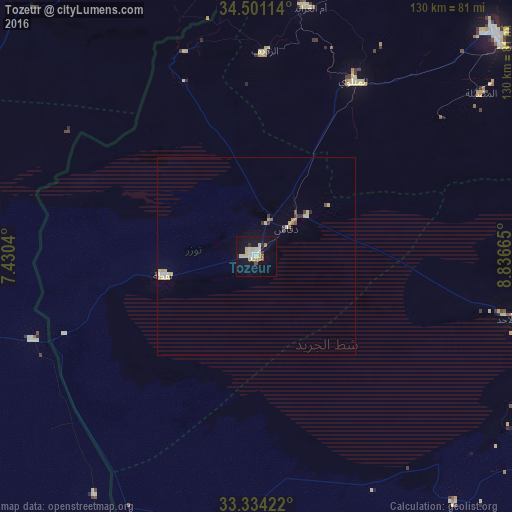
Analysis of Tozeur night lights 2016
Square area 10x10 km:
100  3.32%
3.32%
90-99 2.27%
80-89 7.69%
70-79 1.4%
60-69 0.87%
50-59 2.45%
40-49 0.7%
30-39 0.7%
20-29 1.05%
10-19 20.28%
0-9 59.27%
3.32%90-99
2.27%80-89
7.69%70-79
1.4%60-69
0.87%50-59
2.45%40-49
0.7%30-39
0.7%20-29
1.05%10-19
20.28%0-9
59.27%Square area 50x50 km:
100 0.2%
90-99 0.18%
80-89 0.61%
70-79 0.21%
60-69 0.12%
50-59 0.16%
40-49 0.11%
30-39 0.24%
20-29 0.09%
10-19 0.83%
0-9 97.25%
0.2%90-99
0.18%80-89
0.61%70-79
0.21%60-69
0.12%50-59
0.16%40-49
0.11%30-39
0.24%20-29
0.09%10-19
0.83%0-9
97.25%Clear (daylight) street map image can be seen on geolist.org.
Map coordinates:
34° 30' 4.1" North, 7° 25' 49.4" East
33° 55' 10.8" North, 8° 8' 0.7" East
33° 20' 3.2" North, 8° 50' 11.9" East
Some cities around Tozeur sort by population:
• Gafsa
82.1 km =51 mi,  46°
46°
• Bir el Ater, DZ
92 km =57.2 mi,  355°
355°
• Metlaoui
51 km =31.7 mi,  28°
28°
• Ar Rudayyif
51.5 km =32 mi,  2°
2°
• Nefta
24.2 km =15 mi,  257°
257°
• Kebili
80.8 km =50.2 mi,  107°
107°
• Degache
9.3 km =5.8 mi, 47°
• Jemna
89.9 km =55.9 mi,  115°
115°
2464648 (p: 34,943)
Sources (retrieved 2019-11-25):
» Earth at Night: Flat Maps 2012, 2016