Douz night lights from space
Night Light of Douz (Qibilī) from space (Tunisia) Src. Average luminocity for 10x10km area is 22.0769% and for 50x50km: 1.8345%.
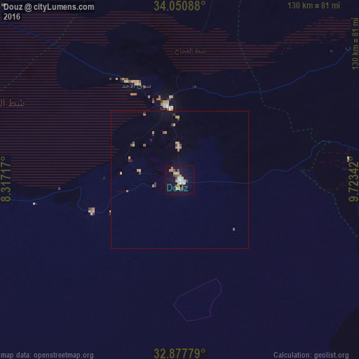
Analysis of Douz night lights 2016
Square area 10x10 km:
100  3.15%
3.15%
90-99 3.85%
80-89 3.15%
70-79 3.5%
60-69 1.92%
50-59 1.75%
40-49 3.5%
30-39 2.27%
20-29 0.17%
10-19 17.31%
0-9 59.44%
3.15%90-99
3.85%80-89
3.15%70-79
3.5%60-69
1.92%50-59
1.75%40-49
3.5%30-39
2.27%20-29
0.17%10-19
17.31%0-9
59.44%Square area 50x50 km:
100 0.16%
90-99 0.19%
80-89 0.35%
70-79 0.28%
60-69 0.24%
50-59 0.16%
40-49 0.24%
30-39 0.28%
20-29 0.07%
10-19 0.88%
0-9 97.15%
0.16%90-99
0.19%80-89
0.35%70-79
0.28%60-69
0.24%50-59
0.16%40-49
0.24%30-39
0.28%20-29
0.07%10-19
0.88%0-9
97.15%Clear (daylight) street map image can be seen on geolist.org.
Map coordinates:
34° 3' 3.2" North, 8° 19' 1.8" East
33° 27' 58.8" North, 9° 1' 13.1" East
32° 52' 40" North, 9° 43' 24.3" East
Some cities around Douz sort by population:
• Gabès
109.9 km =68.3 mi,  65°
65°
• Gafsa
108.8 km =67.6 mi,  348°
348°
• El Hamma
86 km =53.4 mi,  56°
56°
• Tozeur
96.3 km =59.8 mi,  301°
301°
• Kebili
26.9 km =16.7 mi, 349°
• Degache
94.1 km =58.5 mi,  307°
307°
• El Golaa
2.4 km =1.5 mi,  328°
328°
• Jemna
12.4 km =7.7 mi,  357°
357°
2471287 (p: 28,127)
Sources (retrieved 2019-11-25):
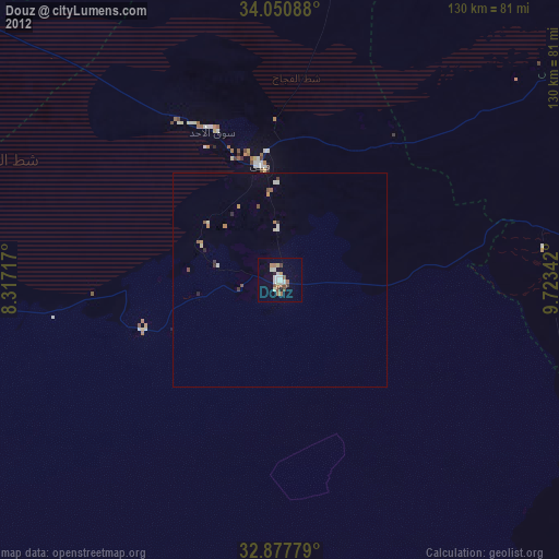
» Earth at Night: Flat Maps 2012, 2016