Chorbane night lights from space
Night Light of Chorbane (Al Mahdīyah) from space (Tunisia) Src. Average luminocity for 10x10km area is 2.3132% and for 50x50km: 0.879%.
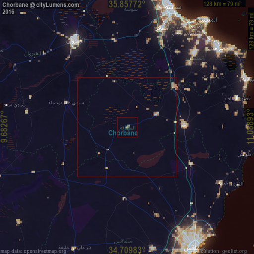
Analysis of Chorbane night lights 2016
Square area 10x10 km:
 0%
0%90-99
0%80-89
0%70-79
0.73%60-69
1.47%50-59
0%40-49
0.73%30-39
0%20-29
0.73%10-19
0.73%0-9
95.6%Square area 50x50 km:
0.06%90-99
0.03%80-89
0.16%70-79
0.18%60-69
0.25%50-59
0.08%40-49
0.13%30-39
0.23%20-29
0.11%10-19
0.06%0-9
98.73%Clear (daylight) street map image can be seen on geolist.org.
Map coordinates:
35° 51' 27.8" North, 9° 40' 57.6" East
35° 17' 8.9" North, 10° 23' 8.9" East
34° 42' 35.4" North, 11° 5' 20.1" East
Some cities around Chorbane sort by population:
• Kairouan
50.9 km =31.6 mi,  328°
328°
• Msaken
52.4 km =32.6 mi,  19°
19°
• Djemmal
50.3 km =31.3 mi,  41°
41°
• El Jem
30.1 km =18.7 mi,  86°
86°
• Ouardenine
53.8 km =33.4 mi,  28°
28°
• Menzel Kamel
45.5 km =28.3 mi, 34°
• Beni Hassane
49.5 km =30.8 mi,  50°
50°
• Sidi Alouane
51.2 km =31.8 mi,  78°
78°
2466897 (p: 6,430)
Sources (retrieved 2019-11-25):
» Earth at Night: Flat Maps 2012, 2016