El Jem night lights from space
Night Light of El Jem (Al Mahdīyah) from space (Tunisia) Src. Average luminocity for 10x10km area is 15.1813% and for 50x50km: 2.8429%.
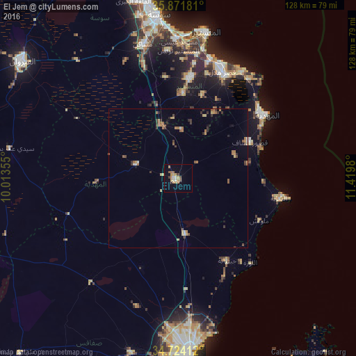
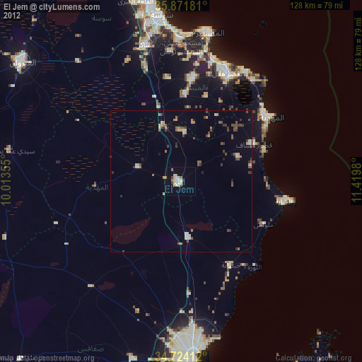
Analysis of El Jem night lights 2016
Square area 10x10 km:
 0.92%
0.92%90-99
2.01%80-89
0.55%70-79
5.86%60-69
3.11%50-59
0.73%40-49
1.47%30-39
1.47%20-29
0.73%10-19
2.38%0-9
80.77%Square area 50x50 km:
0.12%90-99
0.19%80-89
0.35%70-79
0.52%60-69
0.7%50-59
0.4%40-49
0.38%30-39
0.58%20-29
0.33%10-19
0.3%0-9
96.13%Clear (daylight) street map image can be seen on geolist.org.
Map coordinates:
35° 52' 18.5" North, 10° 0' 48.8" East
35° 18' 0" North, 10° 43' 0" East
34° 43' 26.8" North, 11° 25' 11.3" East
Some cities around El Jem sort by population:
• Djemmal
36 km =22.4 mi,  5°
5°
• Ksour Essaf
28.4 km =17.6 mi,  62°
62°
• Menzel Kamel
36.4 km =22.6 mi,  352°
352°
• Beni Hassane
30.9 km =19.2 mi,  15°
15°
• Djebeniana
34.2 km =21.3 mi,  149°
149°
• Sidi Alouane
21.8 km =13.5 mi,  67°
67°
• Melloulèche
32.5 km =20.2 mi,  117°
117°
• Chorbane
30.1 km =18.7 mi,  266°
266°
2473654 (p: 20,029)
Sources (retrieved 2019-11-25):
» Earth at Night: Flat Maps 2012, 2016