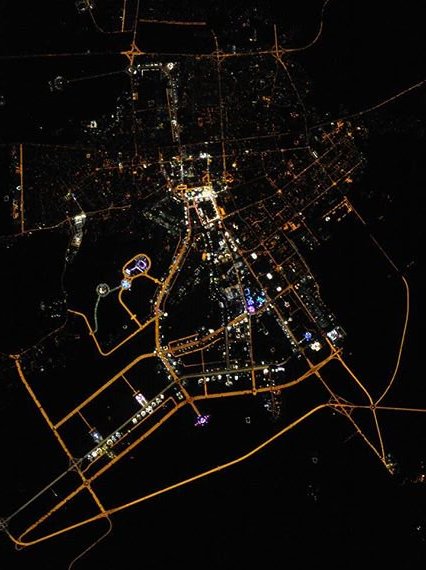
Ashgabat night lights from space
Night Light of Ashgabat from space (Turkmenistan) Src. Average luminocity for 10x10km area is 98.4334% and for 50x50km: 32.5758%.
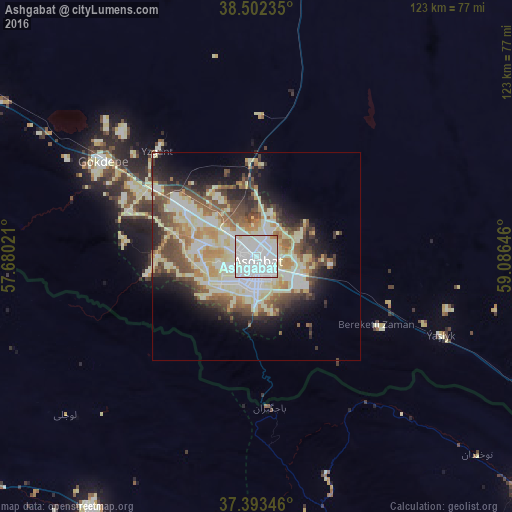
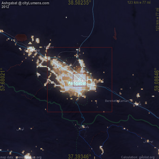

Analysis of Ashgabat night lights 2016
Square area 10x10 km:
 69.97%
90-99
25.49%80-89
2.92%70-79
0.65%60-69
0.97%50-59
0%40-49
0%30-39
0%20-29
0%10-19
0%0-9
0%Square area 50x50 km:
6.12%90-99
8.41%80-89
6.28%70-79
2.95%60-69
3.36%50-59
4.13%40-49
4.98%30-39
3.95%20-29
4.93%10-19
8.25%0-9
46.64%Clear (daylight) street map image can be seen on geolist.org.
Map coordinates:
38° 30' 8.5" North, 57° 40' 48.8" East
37° 57' 0" North, 58° 22' 60" East
37° 23' 36.5" North, 59° 5' 11.3" East
Fantastic image of Ashgabat from space taken by astronauts [src2], but I don't have information about it's orientation, scale or angle. If necessary, it was rotated manually, so North points approximately to upper direction. Click to zoom in:
Some cities around Ashgabat sort by population:
• Bojnūrd, IR
106.7 km =66.3 mi,  240°
240°
• Qūchān, IR
94.5 km =58.7 mi,  173°
173°
• Shīrvān, IR
73.3 km =45.5 mi,  212°
212°
• Esfarāyen, IR
124 km =77.1 mi,  218°
218°
• Abadan
20 km =12.4 mi,  305°
305°
• Annau
13.5 km =8.4 mi,  120°
120°
• Baharly
99.2 km =61.6 mi,  303°
303°
• Kaka
127.4 km =79.2 mi, 121°
162183 (p: 727,700)
Sources (retrieved 2019-11-25):
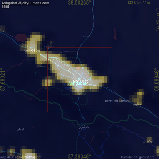
» NASA, Earths city lights 1995
» NASA city lights 2003
» Earth at Night: Flat Maps 2012, 2016
Src.2: Sergey Ryazansky, Twitter/@SergeyISS, 2016-05-22