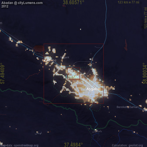
Abadan night lights from space
Night Light of Abadan (Ahal) from space (Turkmenistan) Src. Average luminocity for 10x10km area is 76.5893% and for 50x50km: 36.4167%.
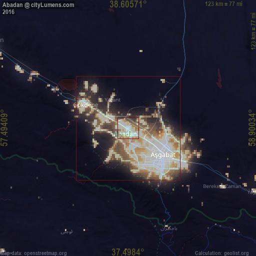
Analysis of Abadan night lights 2016
Square area 10x10 km:
 15.1%
15.1%90-99
23.38%80-89
18.02%70-79
7.63%60-69
8.44%50-59
11.85%40-49
9.42%30-39
4.22%20-29
1.95%10-19
0%0-9
0%Square area 50x50 km:
6.37%90-99
9.51%80-89
7.41%70-79
3.24%60-69
3.46%50-59
3.99%40-49
5.9%30-39
4.44%20-29
6.74%10-19
10.25%0-9
38.69%Clear (daylight) street map image can be seen on geolist.org.
Map coordinates:
38° 36' 20.6" North, 57° 29' 38.7" East
38° 3' 14.9" North, 58° 11' 50" East
37° 29' 54.2" North, 58° 54' 1.2" East
Some cities around Abadan sort by population:
• Ashgabat
20 km =12.4 mi,  125°
125°
• Bojnūrd, IR
99.9 km =62.1 mi,  229°
229°
• Qūchān, IR
109 km =67.7 mi,  165°
165°
• Shīrvān, IR
76.8 km =47.7 mi,  197°
197°
• Esfarāyen, IR
124.4 km =77.3 mi,  209°
209°
• Annau
33.5 km =20.8 mi,  123°
123°
• Baharly
79.2 km =49.2 mi,  302°
302°
• Kaka
147.3 km =91.5 mi, 122°
162099 (p: 39,481)
Sources (retrieved 2019-11-25):
» Earth at Night: Flat Maps 2012, 2016