Vahdat night lights from space
Night Light of Vahdat (Republican Subordination) from space (Tajikistan) Src. Average luminocity for 10x10km area is 7.5519% and for 50x50km: 8.4016%.
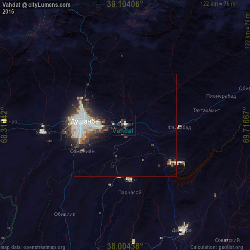
Analysis of Vahdat night lights 2016
Square area 10x10 km:
 0.32%
0.32%90-99
2.27%80-89
0%70-79
0%60-69
0.32%50-59
0%40-49
1.3%30-39
3.25%20-29
4.38%10-19
2.76%0-9
85.39%Square area 50x50 km:
1.99%90-99
2.19%80-89
0.87%70-79
0.62%60-69
0.45%50-59
0.5%40-49
1.33%30-39
1.7%20-29
1.95%10-19
2.84%0-9
85.55%Clear (daylight) street map image can be seen on geolist.org.
Map coordinates:
39° 6' 14.6" North, 68° 18' 37.5" East
38° 33' 22.8" North, 69° 0' 48.7" East
38° 0' 15.8" North, 69° 43' 0" East
Some cities around Vahdat sort by population:
• Dushanbe
20.5 km =12.7 mi,  263°
263°
• Hisor
40.4 km =25.1 mi,  265°
265°
• Boshkengash
20.7 km =12.9 mi,  241°
241°
• Danghara
58.6 km =36.4 mi,  150°
150°
• Norak
32.7 km =20.3 mi,  124°
124°
• Yovon
27 km =16.8 mi,  175°
175°
• Khodzha-Maston
39.6 km =24.6 mi,  301°
301°
• Shahrinav
59 km =36.7 mi, 271°
1220855 (p: 45,693)
Sources (retrieved 2019-11-25):
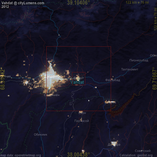
» Earth at Night: Flat Maps 2012, 2016