Norak night lights from space
Night Light of Norak (Khatlon) from space (Tajikistan) Src. Average luminocity for 10x10km area is 13.233% and for 50x50km: 0.9242%.
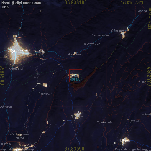
Analysis of Norak night lights 2016
Square area 10x10 km:
 0.34%
0.34%90-99
1.02%80-89
3.57%70-79
2.72%60-69
2.55%50-59
2.21%40-49
0.17%30-39
2.04%20-29
1.36%10-19
2.55%0-9
81.46%Square area 50x50 km:
0.01%90-99
0.09%80-89
0.18%70-79
0.13%60-69
0.13%50-59
0.25%40-49
0.08%30-39
0.23%20-29
0.09%10-19
0.11%0-9
98.69%Clear (daylight) street map image can be seen on geolist.org.
Map coordinates:
38° 56' 17.4" North, 68° 37' 10.6" East
38° 23' 21" North, 69° 19' 21.8" East
37° 50' 9.5" North, 70° 1' 33.1" East
Some cities around Norak sort by population:
• Dushanbe
50.1 km =31.1 mi,  288°
288°
• Vahdat
32.7 km =20.3 mi,  304°
304°
• Boshkengash
45.9 km =28.5 mi,  280°
280°
• Danghara
32.7 km =20.3 mi,  177°
177°
• Yovon
26.2 km =16.3 mi,  251°
251°
• Obigarm
49.6 km =30.8 mi,  42°
42°
• Sovet
44.6 km =27.7 mi,  148°
148°
• Roghun
64.7 km =40.2 mi,  47°
47°
1220905 (p: 18,122)
Sources (retrieved 2019-11-25):
» Earth at Night: Flat Maps 2012, 2016