Khŭjand night lights from space
Night Light of Khŭjand (Sughd) from space (Tajikistan) Src. Average luminocity for 10x10km area is 46.6446% and for 50x50km: 4.0653%.
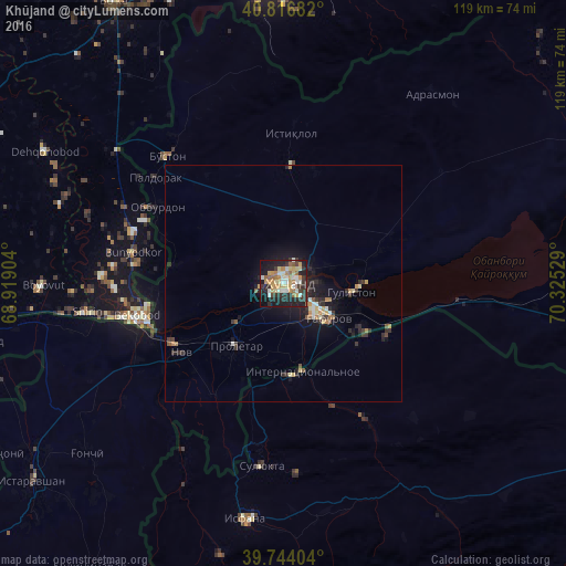
Analysis of Khŭjand night lights 2016
Square area 10x10 km:
 4.76%
4.76%90-99
8.67%80-89
7.99%70-79
10.54%60-69
6.8%50-59
4.42%40-49
1.53%30-39
11.9%20-29
16.84%10-19
23.47%0-9
3.06%Square area 50x50 km:
0.34%90-99
0.49%80-89
0.56%70-79
0.68%60-69
0.51%50-59
0.38%40-49
0.18%30-39
1.09%20-29
1.45%10-19
3.43%0-9
90.89%Clear (daylight) street map image can be seen on geolist.org.
Map coordinates:
40° 49' 0.6" North, 68° 55' 8.5" East
40° 16' 57.2" North, 69° 37' 19.8" East
39° 44' 38.5" North, 70° 19' 31" East
Some cities around Khŭjand sort by population:
• Bekobod, UZ
30.7 km =19.1 mi,  257°
257°
• Chkalov
8.2 km =5.1 mi,  131°
131°
• Proletar
16.4 km =10.2 mi,  218°
218°
• Suluktu, KG
38.8 km =24.1 mi,  186°
186°
• Nov
25.8 km =16 mi,  235°
235°
• Bŭston
36.2 km =22.5 mi,  317°
317°
• Taboshar
32 km =19.9 mi,  2°
2°
• Konsoy
24.2 km =15 mi,  16°
16°
1514879 (p: 144,865)
Sources (retrieved 2019-11-25):
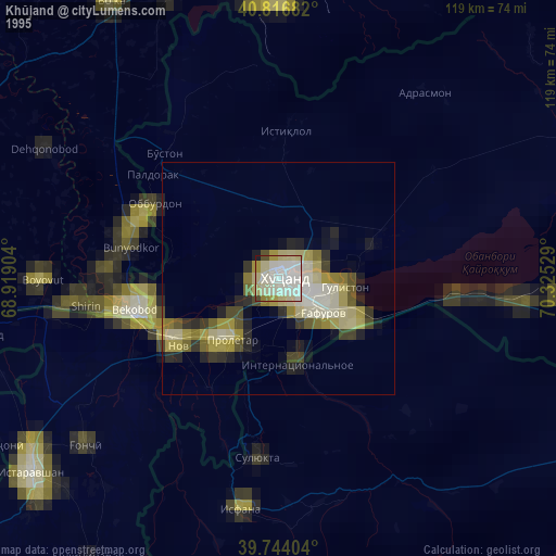
» NASA, Earths city lights 1995
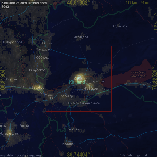
» NASA city lights 2003
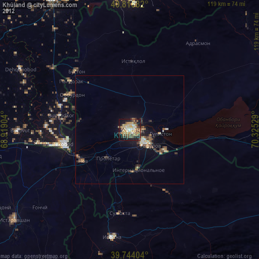
» Earth at Night: Flat Maps 2012, 2016