Udon Thani night lights from space
Night Light of Udon Thani from space (Thailand) Src. Average luminocity for 10x10km area is 81.2169% and for 50x50km: 11.6592%.
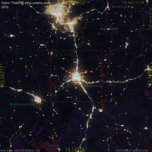
Analysis of Udon Thani night lights 2016
Square area 10x10 km:
 23.35%
90-99
24.59%80-89
17.98%70-79
11.16%60-69
3.51%50-59
4.96%40-49
9.3%30-39
2.89%20-29
2.27%10-19
0%0-9
0%Square area 50x50 km:
0.97%90-99
1.83%80-89
2.07%70-79
1.61%60-69
0.95%50-59
0.89%40-49
2.75%30-39
2.58%20-29
3.53%10-19
6.66%0-9
76.17%Clear (daylight) street map image can be seen on geolist.org.
Map coordinates:
18° 5' 7.2" North, 102° 4' 58" East
17° 24' 56.4" North, 102° 47' 9.2" East
16° 44' 36.8" North, 103° 29' 20.5" East
Some cities around Udon Thani sort by population:
• Nong Khai
51.7 km =32.1 mi,  354°
354°
• Tha Bo
52.9 km =32.9 mi,  335°
335°
• Nong Bua Lamphu
43.5 km =27 mi,  237°
237°
• Ban Phan Don
36.3 km =22.6 mi,  146°
146°
• Kut Chap
23.3 km =14.5 mi,  272°
272°
• Ban Nong Wua So
49.4 km =30.7 mi,  109°
109°
• Ban Dung
59.3 km =36.8 mi,  57°
57°
• Nong Wua So
36.1 km =22.4 mi,  218°
218°
1605239 (p: 247,231)
Sources (retrieved 2019-11-25):
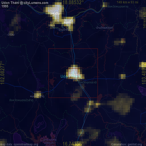
» NASA, Earths city lights 1995
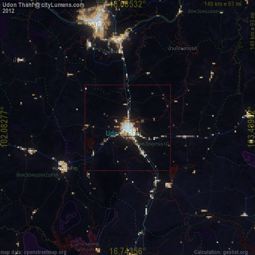
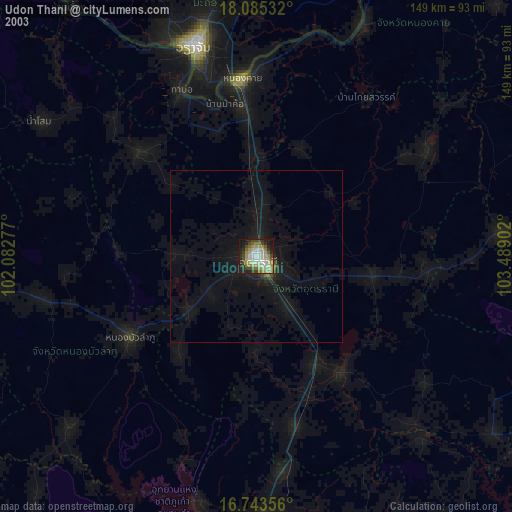
» NASA city lights 2003
» Earth at Night: Flat Maps 2012, 2016