Nong Khai night lights from space
Night Light of Nong Khai from space (Thailand) Src. Average luminocity for 10x10km area is 67.7835% and for 50x50km: 22.1715%.
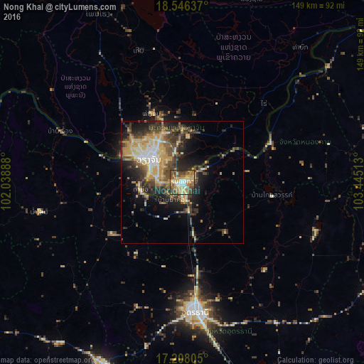
Analysis of Nong Khai night lights 2016
Square area 10x10 km:
 5.63%
5.63%90-99
10.82%80-89
18.18%70-79
17.1%60-69
10.39%50-59
10.39%40-49
20.56%30-39
3.9%20-29
3.03%10-19
0%0-9
0%Square area 50x50 km:
1.75%90-99
3.42%80-89
3.91%70-79
4.53%60-69
2.45%50-59
2.92%40-49
5.17%30-39
4.46%20-29
6.19%10-19
8.23%0-9
56.97%Clear (daylight) street map image can be seen on geolist.org.
Map coordinates:
18° 32' 46.9" North, 102° 2' 20" East
17° 52' 42.5" North, 102° 44' 31.2" East
17° 12' 29" North, 103° 26' 42.5" East
Some cities around Nong Khai sort by population:
• Udon Thani
51.7 km =32.1 mi,  174°
174°
• Vientiane, LA
17.9 km =11.1 mi,  303°
303°
• Tha Bo
17.3 km =10.7 mi,  259°
259°
• Kut Chap
53.7 km =33.4 mi,  200°
200°
• Ban Dung
58.3 km =36.2 mi,  110°
110°
• Nam Som
59.7 km =37.1 mi, 258°
• Phon Charoen
48.1 km =29.9 mi,  69°
69°
• Si Chiang Mai
18.6 km =11.6 mi, 297°
1608232 (p: 63,609)
Sources (retrieved 2019-11-25):
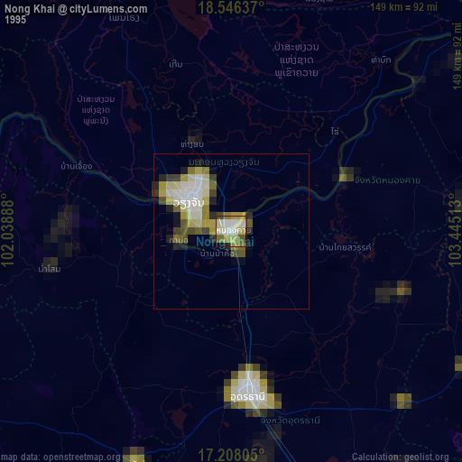
» NASA, Earths city lights 1995
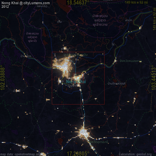
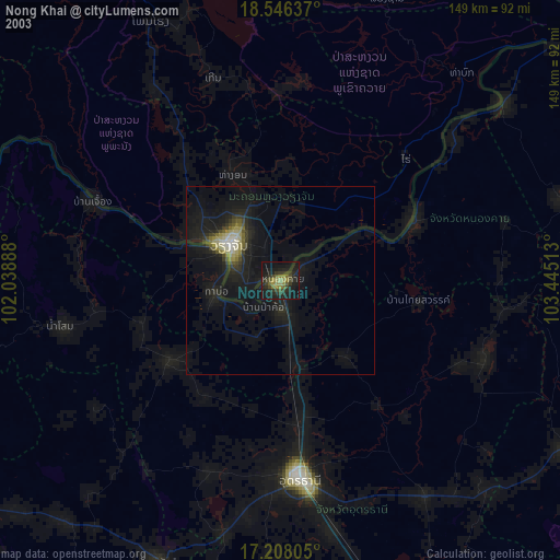
» NASA city lights 2003
» Earth at Night: Flat Maps 2012, 2016