Nong Wua So night lights from space
Night Light of Nong Wua So (Udon Thani) from space (Thailand) Src. Average luminocity for 10x10km area is 2.3967% and for 50x50km: 5.7187%.
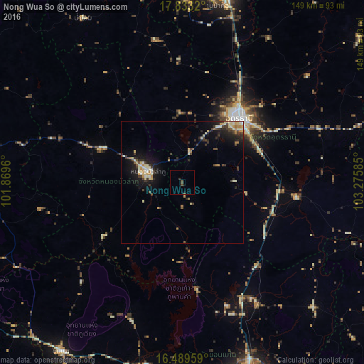
Analysis of Nong Wua So night lights 2016
Square area 10x10 km:
 0%
0%90-99
0%80-89
0%70-79
0.41%60-69
0%50-59
0.21%40-49
2.27%30-39
0.83%20-29
0%10-19
1.65%0-9
94.63%Square area 50x50 km:
0.27%90-99
0.94%80-89
1.2%70-79
0.71%60-69
0.44%50-59
0.39%40-49
0.92%30-39
1.32%20-29
1.61%10-19
4.29%0-9
87.91%Clear (daylight) street map image can be seen on geolist.org.
Map coordinates:
17° 49' 59.5" North, 101° 52' 10.6" East
17° 9' 45.4" North, 102° 34' 21.8" East
16° 29' 22.5" North, 103° 16' 33.1" East
Some cities around Nong Wua So sort by population:
• Udon Thani
36.1 km =22.4 mi,  38°
38°
• Na Klang
43.8 km =27.2 mi,  291°
291°
• Ban Phan Don
42.5 km =26.4 mi,  92°
92°
• Kut Chap
29.3 km =18.2 mi,  358°
358°
• Ban Nong Wua So
70.2 km =43.6 mi,  80°
80°
• Kranuan
73.9 km =45.9 mi,  133°
133°
• Si Bun Rueang
38.3 km =23.8 mi,  235°
235°
• Non Sang
32.7 km =20.3 mi,  181°
181°
1599641 (p: 7,503)
Sources (retrieved 2019-11-25):
» Earth at Night: Flat Maps 2012, 2016