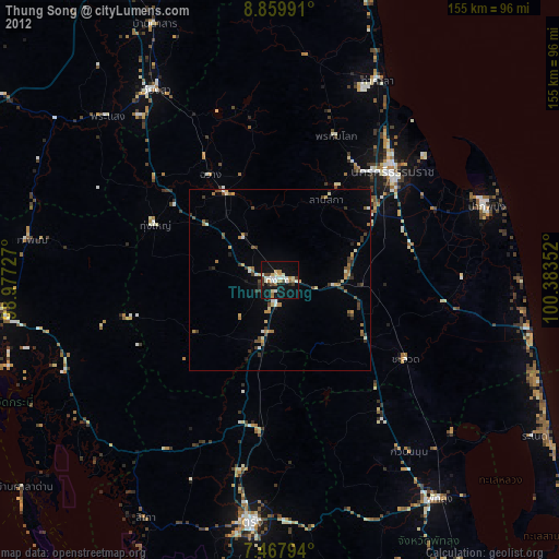
Thung Song night lights from space
Night Light of Thung Song (Nakhon Si Thammarat) from space (Thailand) Src. Average luminocity for 10x10km area is 37.6116% and for 50x50km: 4.656%.
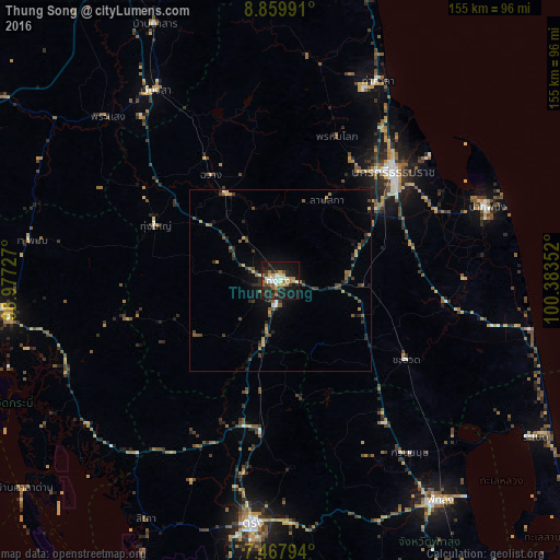
Analysis of Thung Song night lights 2016
Square area 10x10 km:
 6.4%
6.4%90-99
4.34%80-89
4.75%70-79
5.99%60-69
5.58%50-59
4.34%40-49
3.93%30-39
5.79%20-29
13.22%10-19
36.78%0-9
8.88%Square area 50x50 km:
0.29%90-99
0.28%80-89
0.62%70-79
0.53%60-69
0.64%50-59
0.8%40-49
0.93%30-39
0.93%20-29
1.72%10-19
3.06%0-9
90.19%Clear (daylight) street map image can be seen on geolist.org.
Map coordinates:
8° 51' 35.7" North, 98° 58' 38.2" East
8° 9' 52.3" North, 99° 40' 49.4" East
7° 28' 4.6" North, 100° 23' 0.7" East
Some cities around Thung Song sort by population:
• Nakhon Si Thammarat
43.4 km =27 mi,  46°
46°
• Trang
68.1 km =42.3 mi,  186°
186°
• Ron Phibun
19.2 km =11.9 mi,  85°
85°
• Pak Phanang
61 km =37.9 mi,  70°
70°
• Huai Yot
42 km =26.1 mi, 186°
• Wiang Sa
62.8 km =39 mi,  326°
326°
• Chawang
34.9 km =21.7 mi, 326°
• Tham Phannara
42.4 km =26.3 mi,  312°
312°
1150085 (p: 28,223)
Sources (retrieved 2019-11-25):
» Earth at Night: Flat Maps 2012, 2016