Nong Ki night lights from space
Night Light of Nong Ki (Buriram) from space (Thailand) Src. Average luminocity for 10x10km area is 8.9814% and for 50x50km: 1.4754%.
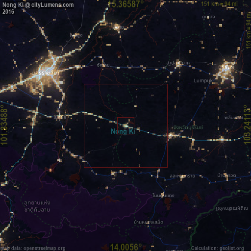
Analysis of Nong Ki night lights 2016
Square area 10x10 km:
 0%
0%90-99
0.83%80-89
0.83%70-79
0.83%60-69
1.86%50-59
1.45%40-49
4.96%30-39
0.83%20-29
2.48%10-19
1.65%0-9
84.3%Square area 50x50 km:
0%90-99
0.07%80-89
0.34%70-79
0.12%60-69
0.15%50-59
0.21%40-49
0.45%30-39
0.47%20-29
0.49%10-19
0.27%0-9
97.43%Clear (daylight) street map image can be seen on geolist.org.
Map coordinates:
15° 21' 57.1" North, 101° 50' 5.6" East
14° 41' 12.4" North, 102° 32' 16.8" East
14° 0' 20.2" North, 103° 14' 28.1" East
Some cities around Nong Ki sort by population:
• Nakhon Ratchasima
56.5 km =35.1 mi,  303°
303°
• Chok Chai
40.4 km =25.1 mi,  276°
276°
• Nang Rong
27.8 km =17.3 mi,  101°
101°
• Khon Buri
36.2 km =22.5 mi,  240°
240°
• Non Sung
62.6 km =38.9 mi,  331°
331°
• Ban Huai Thalaeng
35.1 km =21.8 mi,  20°
20°
• Soeng Sang
30.1 km =18.7 mi,  196°
196°
• Phimai
59.8 km =37.2 mi,  355°
355°
1608222 (p: 13,592)
Sources (retrieved 2019-11-25):
» Earth at Night: Flat Maps 2012, 2016