Phichit night lights from space
Night Light of Phichit from space (Thailand) Src. Average luminocity for 10x10km area is 44.6653% and for 50x50km: 6.2676%.
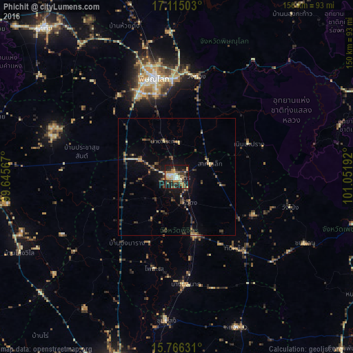
Analysis of Phichit night lights 2016
Square area 10x10 km:
 2.69%
2.69%90-99
5.58%80-89
10.33%70-79
7.85%60-69
7.85%50-59
6.2%40-49
6.61%30-39
9.5%20-29
10.95%10-19
30.58%0-9
1.86%Square area 50x50 km:
0.11%90-99
0.37%80-89
1.09%70-79
0.81%60-69
0.66%50-59
0.97%40-49
1.41%30-39
2.1%20-29
1.35%10-19
4.33%0-9
86.8%Clear (daylight) street map image can be seen on geolist.org.
Map coordinates:
17° 6' 54.1" North, 99° 38' 44.4" East
16° 26' 30.6" North, 100° 20' 55.6" East
15° 45' 58.7" North, 101° 3' 6.9" East
Some cities around Phichit sort by population:
• Phitsanulok
43.7 km =27.2 mi,  347°
347°
• Taphan Hin
25.7 km =16 mi,  162°
162°
• Bang Krathum
16 km =9.9 mi,  341°
341°
• Bang Rakam
43 km =26.7 mi,  324°
324°
• Bang Mun Nak
46.1 km =28.6 mi,  175°
175°
• Thap Khlo
41 km =25.5 mi,  139°
139°
• Wang Sai Phun
21 km =13 mi,  106°
106°
• Lan Krabue
56.1 km =34.9 mi,  288°
288°
1607725 (p: 35,760)
Sources (retrieved 2019-11-25):
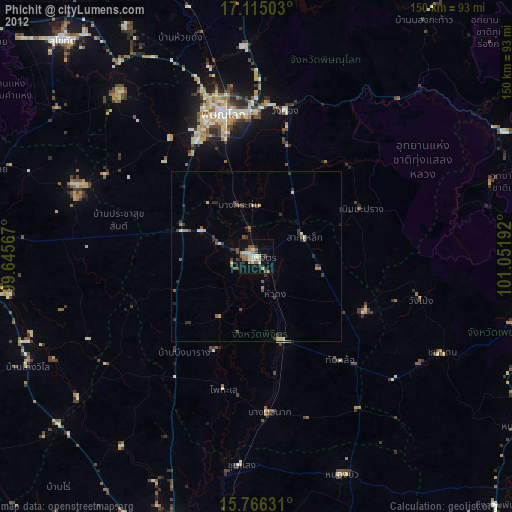
» Earth at Night: Flat Maps 2012, 2016