Phon Charoen night lights from space
Night Light of Phon Charoen (Nong Khai) from space (Thailand) Src. Average luminocity for 10x10km area is 0.3009% and for 50x50km: 1.3118%.
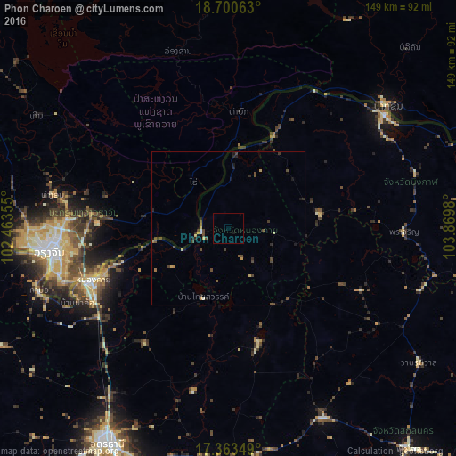
Analysis of Phon Charoen night lights 2016
Square area 10x10 km:
 0%
0%90-99
0%80-89
0%70-79
0%60-69
0%50-59
0%40-49
0%30-39
0%20-29
0%10-19
0.87%0-9
99.13%Square area 50x50 km:
0%90-99
0.13%80-89
0.15%70-79
0.2%60-69
0.07%50-59
0.19%40-49
0.69%30-39
0.18%20-29
0.48%10-19
0.38%0-9
97.53%Clear (daylight) street map image can be seen on geolist.org.
Map coordinates:
18° 42' 2.3" North, 102° 27' 48.8" East
18° 1' 60" North, 103° 10' 0" East
17° 21' 48.6" North, 103° 52' 11.3" East
Some cities around Phon Charoen sort by population:
• Vientiane, LA
60.4 km =37.5 mi,  262°
262°
• Nong Khai
48.1 km =29.9 mi,  249°
249°
• Tha Bo
65.2 km =40.5 mi, 251°
• Pakxan, LA
65.9 km =40.9 mi,  52°
52°
• Ban Dung
38.5 km =23.9 mi,  165°
165°
• Sawang Daen Din
69.3 km =43.1 mi,  153°
153°
• Si Chiang Mai
61.9 km =38.5 mi, 262°
• Bueng Kan
63 km =39.1 mi, 54°
1607615 (p: 15,208)
Sources (retrieved 2019-11-25):
» Earth at Night: Flat Maps 2012, 2016