Na Mom night lights from space
Night Light of Na Mom (Songkhla) from space (Thailand) Src. Average luminocity for 10x10km area is 18.2359% and for 50x50km: 17.057%.
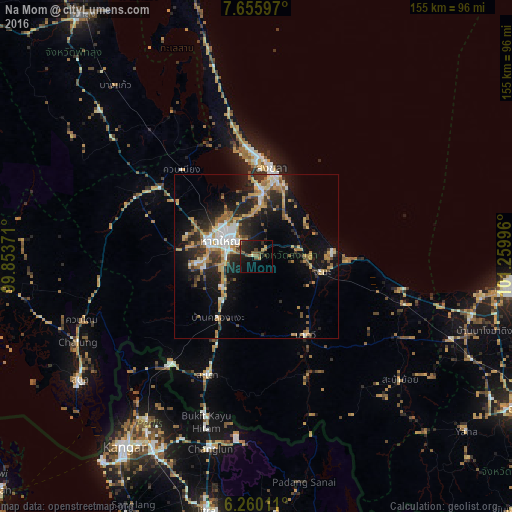
Analysis of Na Mom night lights 2016
Square area 10x10 km:
 0%
0%90-99
1.08%80-89
1.3%70-79
2.81%60-69
2.6%50-59
4.55%40-49
4.11%30-39
3.46%20-29
9.74%10-19
19.91%0-9
50.43%Square area 50x50 km:
2.28%90-99
1.83%80-89
1.71%70-79
3.5%60-69
2.56%50-59
2.15%40-49
2.01%30-39
2.81%20-29
5.65%10-19
11.42%0-9
64.07%Clear (daylight) street map image can be seen on geolist.org.
Map coordinates:
7° 39' 21.5" North, 99° 51' 13.4" East
6° 57' 30.8" North, 100° 33' 24.6" East
6° 15' 36.4" North, 101° 15' 35.9" East
Some cities around Na Mom sort by population:
• Hat Yai
10.4 km =6.5 mi,  302°
302°
• Ban Mai
27.3 km =17 mi,  357°
357°
• Songkhla
27 km =16.8 mi,  8°
8°
• Kangar, MY
69.8 km =43.4 mi,  214°
214°
• Sadao
38.5 km =23.9 mi,  202°
202°
• Pattani
77.2 km =48 mi,  97°
97°
• Satun
65.7 km =40.8 mi,  235°
235°
• Nong Chik
69.8 km =43.4 mi, 100°
1600983 (p: 7,537)
Sources (retrieved 2019-11-25):
» Earth at Night: Flat Maps 2012, 2016