Bua Yai night lights from space
Night Light of Bua Yai (Nakhon Ratchasima) from space (Thailand) Src. Average luminocity for 10x10km area is 16.5043% and for 50x50km: 2.6634%.
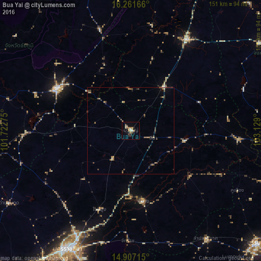
Analysis of Bua Yai night lights 2016
Square area 10x10 km:
 0.43%
0.43%90-99
3.03%80-89
1.95%70-79
4.55%60-69
2.81%50-59
1.08%40-49
0.87%30-39
1.73%20-29
3.68%10-19
4.55%0-9
75.32%Square area 50x50 km:
0.03%90-99
0.18%80-89
0.28%70-79
0.48%60-69
0.68%50-59
0.4%40-49
0.53%30-39
0.73%20-29
0.62%10-19
0.42%0-9
95.65%Clear (daylight) street map image can be seen on geolist.org.
Map coordinates:
16° 15' 42" North, 101° 43' 21.9" East
15° 35' 7.9" North, 102° 25' 33.1" East
14° 54' 25.7" North, 103° 7' 44.4" East
Some cities around Bua Yai sort by population:
• Chaiyaphum
49.3 km =30.6 mi,  300°
300°
• Ban Phai
62 km =38.5 mi,  31°
31°
• Kaeng Khro
60.9 km =37.8 mi,  342°
342°
• Non Sung
48.6 km =30.2 mi,  201°
201°
• Phon
31.7 km =19.7 mi,  35°
35°
• Phimai
41 km =25.5 mi,  169°
169°
• Non Thai
57.6 km =35.8 mi,  221°
221°
• Kham Sakae Saeng
39.1 km =24.3 mi, 223°
1611492 (p: 16,832)
Sources (retrieved 2019-11-25):
» Earth at Night: Flat Maps 2012, 2016