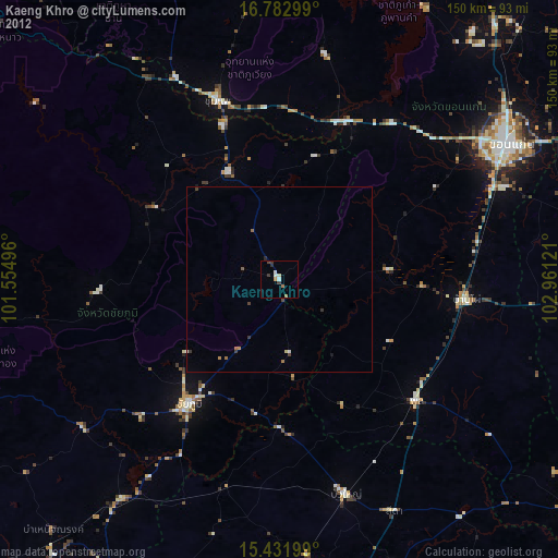
Kaeng Khro night lights from space
Night Light of Kaeng Khro (Chaiyaphum) from space (Thailand) Src. Average luminocity for 10x10km area is 9.9112% and for 50x50km: 1.2507%.
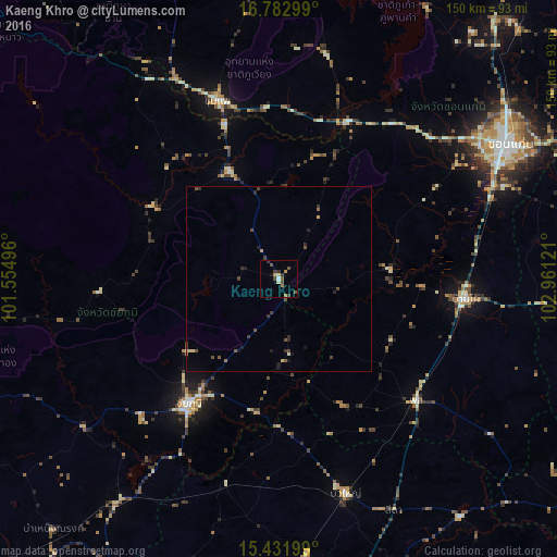
Analysis of Kaeng Khro night lights 2016
Square area 10x10 km:
 0.41%
0.41%90-99
1.03%80-89
1.03%70-79
0.62%60-69
2.69%50-59
1.03%40-49
3.51%30-39
2.89%20-29
1.65%10-19
1.03%0-9
84.09%Square area 50x50 km:
0.02%90-99
0.06%80-89
0.18%70-79
0.08%60-69
0.16%50-59
0.2%40-49
0.52%30-39
0.38%20-29
0.36%10-19
0.37%0-9
97.68%Clear (daylight) street map image can be seen on geolist.org.
Map coordinates:
16° 46' 58.8" North, 101° 33' 17.9" East
16° 6' 31.1" North, 102° 15' 29.1" East
15° 25' 55.2" North, 102° 57' 40.4" East
Some cities around Kaeng Khro sort by population:
• Khon Kaen
72 km =44.7 mi,  58°
58°
• Chaiyaphum
41.2 km =25.6 mi,  216°
216°
• Chum Phae
51.3 km =31.9 mi,  340°
340°
• Ban Phai
50.8 km =31.6 mi,  96°
96°
• Phu Khiao
32.8 km =20.4 mi, 335°
• Kaset Sombun
37.7 km =23.4 mi,  300°
300°
• Bua Yai
60.9 km =37.8 mi,  162°
162°
• Phon
48.9 km =30.4 mi,  131°
131°
1610505 (p: 29,056)
Sources (retrieved 2019-11-25):
» Earth at Night: Flat Maps 2012, 2016