N'Djamena night lights from space
Night Light of N'Djamena (Chari-Baguirmi) from space (Chad) Src. Average luminocity for 10x10km area is 65.4298% and for 50x50km: 6.0084%.
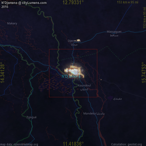
Analysis of N'Djamena night lights 2016
Square area 10x10 km:
 20.66%
90-99
19.63%80-89
5.17%70-79
4.96%60-69
4.34%50-59
8.68%40-49
7.23%30-39
7.64%20-29
11.78%10-19
9.3%0-9
0.62%Square area 50x50 km:
1.04%90-99
1%80-89
0.92%70-79
1.14%60-69
0.25%50-59
0.51%40-49
0.8%30-39
0.85%20-29
1.54%10-19
4.03%0-9
87.92%Clear (daylight) street map image can be seen on geolist.org.
Map coordinates:
12° 47' 35.9" North, 14° 20' 28.6" East
12° 6' 24.2" North, 15° 2' 39.8" East
11° 25' 6.1" North, 15° 44' 51.1" East
Some cities around N'Djamena sort by population:
• Kousséri, CM
3.6 km =2.2 mi,  204°
204°
• Gamboru, NG
95.7 km =59.5 mi,  288°
288°
• Dikwa, NG
122.7 km =76.2 mi,  266°
266°
• Massaguet
59.1 km =36.7 mi,  46°
46°
• Dourbali
95.5 km =59.3 mi,  110°
110°
• Massakory
123.7 km =76.9 mi,  36°
36°
• Ngala, NG
96.8 km =60.1 mi, 285°
• Makary, CM
82.6 km =51.3 mi,  309°
309°
2427123 (p: 721,081)
Sources (retrieved 2019-11-25):
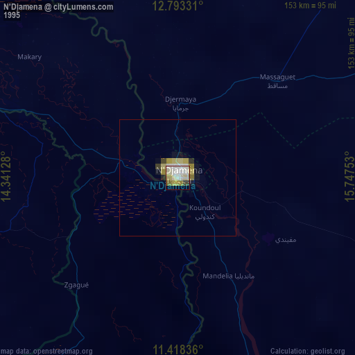
» NASA, Earths city lights 1995
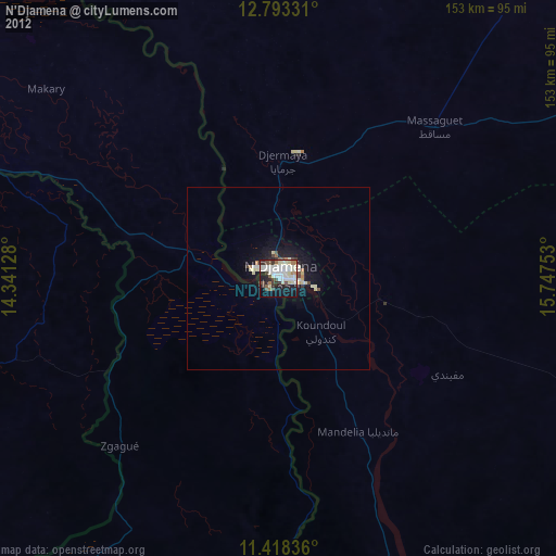
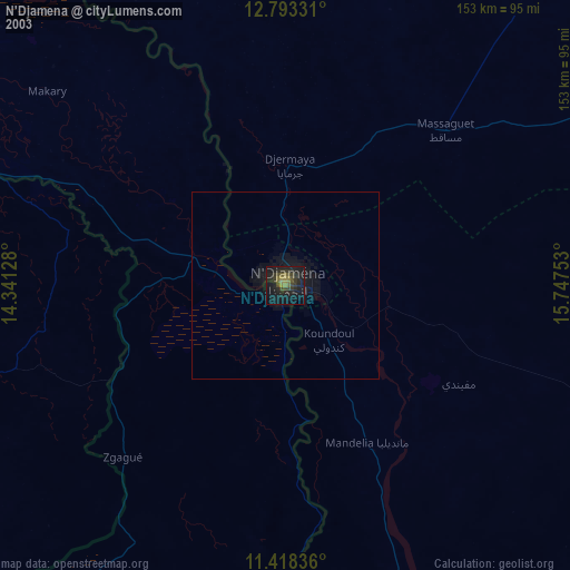
» NASA city lights 2003
» Earth at Night: Flat Maps 2012, 2016