Ţafas night lights from space
Night Light of Ţafas (Daraa) from space (Syria) Src. Average luminocity for 10x10km area is 0.0402% and for 50x50km: 13.432%.
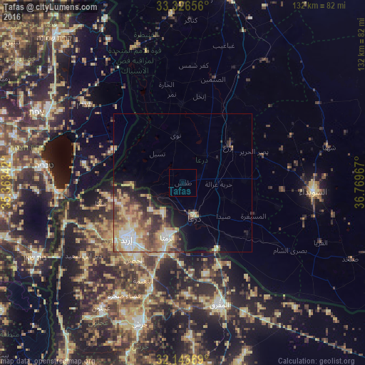
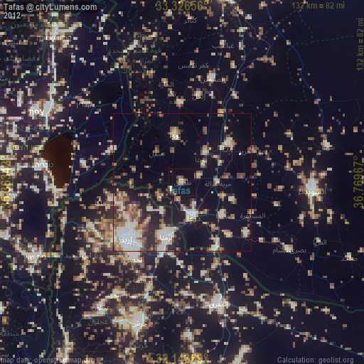
Analysis of Ţafas night lights 2016
Square area 10x10 km:
 0%
0%90-99
0%80-89
0%70-79
0%60-69
0%50-59
0%40-49
0%30-39
0%20-29
0%10-19
0%0-9
100%Square area 50x50 km:
1.65%90-99
1.83%80-89
3.18%70-79
2.55%60-69
1.5%50-59
2.18%40-49
2.36%30-39
2.04%20-29
2.5%10-19
3.35%0-9
76.87%Clear (daylight) street map image can be seen on geolist.org.
Map coordinates:
33° 19' 35.6" North, 35° 21' 48.3" East
32° 44' 13.5" North, 36° 3' 59.5" East
32° 8' 37.3" North, 36° 46' 10.8" East
Some cities around Ţafas sort by population:
• Dar‘ā
13.6 km =8.5 mi,  165°
165°
• Ar Ramthā, JO
20.6 km =12.8 mi,  195°
195°
• Ash Shaykh Miskīn
13.4 km =8.3 mi,  40°
40°
• Al Ḩarāk
22.8 km =14.2 mi,  86°
86°
• Aţ Ţurrah, JO
13 km =8.1 mi,  213°
213°
• Izra‘
23 km =14.3 mi,  49°
49°
• Ash Shajarah, JO
15.6 km =9.7 mi,  228°
228°
• Kharjā, JO
18.8 km =11.7 mi,  242°
242°
163806 (p: 31,249)
Sources (retrieved 2019-11-25):
» Earth at Night: Flat Maps 2012, 2016