Kharjā night lights from space
Night Light of Kharjā (Irbid) from space (Jordan) Src. Average luminocity for 10x10km area is 49.1206% and for 50x50km: 28.7074%.
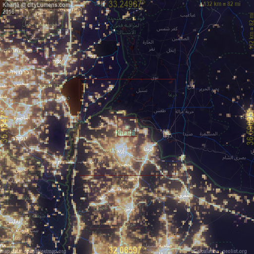
Analysis of Kharjā night lights 2016
Square area 10x10 km:
 0.35%
0.35%90-99
1.4%80-89
14.16%70-79
13.81%60-69
5.94%50-59
11.19%40-49
12.59%30-39
12.06%20-29
16.61%10-19
10.66%0-9
1.22%Square area 50x50 km:
1.99%90-99
2.52%80-89
6.75%70-79
5.67%60-69
3.57%50-59
4.9%40-49
6.26%30-39
5.5%20-29
8.36%10-19
13.48%0-9
41.01%Clear (daylight) street map image can be seen on geolist.org.
Map coordinates:
33° 14' 59.5" North, 35° 11' 4.9" East
32° 39' 35.6" North, 35° 53' 16.2" East
32° 3' 57.5" North, 36° 35' 27.4" East
Some cities around Kharjā sort by population:
• Irbid
12.1 km =7.5 mi,  196°
196°
• Aţ Ţurrah
9.8 km =6.1 mi,  103°
103°
• Ash Shajarah
5.4 km =3.4 mi,  109°
109°
• Kafr Sawm
8.6 km =5.3 mi,  289°
289°
• Ḩakamā
7.4 km =4.6 mi,  183°
183°
• Sāl
10.4 km =6.5 mi,  167°
167°
• Saḩam al Kaffārāt
11.5 km =7.1 mi, 292°
• Ḩātim
10.4 km =6.5 mi,  260°
260°
248627 (p: 5,498)
Sources (retrieved 2019-11-25):
» Earth at Night: Flat Maps 2012, 2016