Santa Tecla night lights from space
Night Light of Santa Tecla (La Libertad) from space (El Salvador) Src. Average luminocity for 10x10km area is 53.2686% and for 50x50km: 15.8196%.
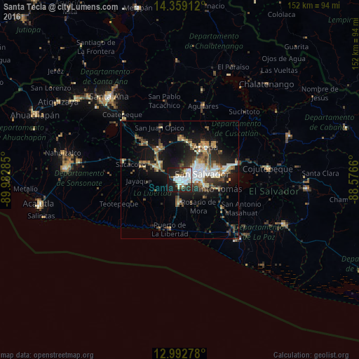

Analysis of Santa Tecla night lights 2016
Square area 10x10 km:
 15.5%
15.5%90-99
17.77%80-89
4.75%70-79
0.62%60-69
2.48%50-59
3.31%40-49
5.58%30-39
7.44%20-29
17.56%10-19
23.97%0-9
1.03%Square area 50x50 km:
2.27%90-99
2.71%80-89
1.83%70-79
1.13%60-69
1.88%50-59
2.72%40-49
2.49%30-39
2.88%20-29
4.47%10-19
10.76%0-9
66.87%Clear (daylight) street map image can be seen on geolist.org.
Map coordinates:
14° 21' 32.8" North, 89° 58' 58.3" West
13° 40' 37" North, 89° 16' 47" West
12° 59' 34" North, 88° 34' 35.8" West
Some cities around Santa Tecla sort by population:
• San Salvador
10.1 km =6.3 mi,  82°
82°
• Mejicanos
10.1 km =6.3 mi,  45°
45°
• San Marcos
10.6 km =6.6 mi,  100°
100°
• Cuscatancingo
12.5 km =7.8 mi,  58°
58°
• Antiguo Cuscatlán
3.2 km =2 mi,  114°
114°
• Ayutuxtepeque
11 km =6.8 mi, 46°
• Zaragoza
9.8 km =6.1 mi,  185°
185°
• Nuevo Cuscatlán
3.5 km =2.2 mi,  153°
153°
3584257 (p: 124,694)
Sources (retrieved 2019-11-25):
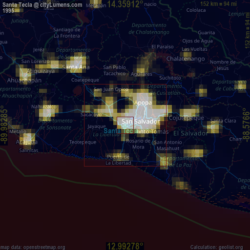
» NASA, Earths city lights 1995
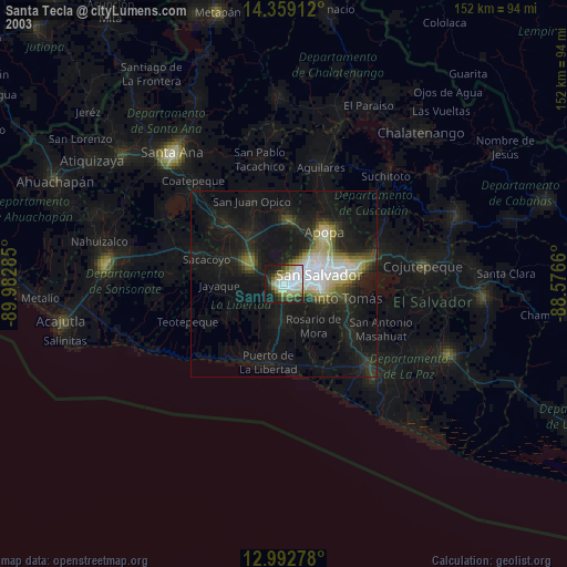
» NASA city lights 2003
» Earth at Night: Flat Maps 2012, 2016