Zaragoza night lights from space
Night Light of Zaragoza (La Libertad) from space (El Salvador) Src. Average luminocity for 10x10km area is 13.0103% and for 50x50km: 14.2026%.
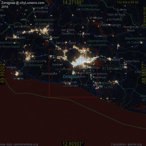
Analysis of Zaragoza night lights 2016
Square area 10x10 km:
 0.41%
0.41%90-99
0.62%80-89
0.62%70-79
0.83%60-69
2.07%50-59
4.75%40-49
2.48%30-39
0.62%20-29
2.69%10-19
19.63%0-9
65.29%Square area 50x50 km:
2.29%90-99
2.67%80-89
1.6%70-79
0.96%60-69
1.56%50-59
2.4%40-49
2.28%30-39
2.37%20-29
4.21%10-19
9.16%0-9
70.49%Clear (daylight) street map image can be seen on geolist.org.
Map coordinates:
14° 16' 18.8" North, 89° 59' 31.3" West
13° 35' 22" North, 89° 17' 20" West
12° 54' 18.1" North, 88° 35' 8.8" West
Some cities around Zaragoza sort by population:
• San Salvador
15.6 km =9.7 mi,  44°
44°
• Santa Tecla
9.8 km =6.1 mi,  5°
5°
• San Marcos
13.8 km =8.6 mi,  55°
55°
• Antiguo Cuscatlán
9.2 km =5.7 mi,  24°
24°
• La Libertad
11.8 km =7.3 mi,  197°
197°
• Panchimalco
12.1 km =7.5 mi,  77°
77°
• Nuevo Cuscatlán
7.1 km =4.4 mi, 21°
• Rosario de Mora
8.8 km =5.5 mi,  100°
100°
3582790 (p: 11,749)
Sources (retrieved 2019-11-25):
» Earth at Night: Flat Maps 2012, 2016