San Marcos night lights from space
Night Light of San Marcos (San Salvador) from space (El Salvador) Src. Average luminocity for 10x10km area is 56.7913% and for 50x50km: 15.486%.
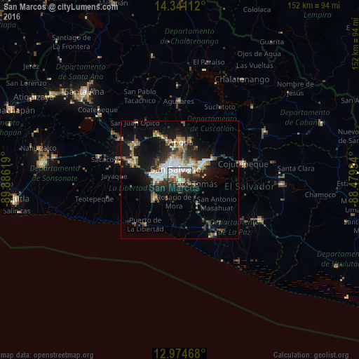


Analysis of San Marcos night lights 2016
Square area 10x10 km:
 16.94%
90-99
14.88%80-89
5.99%70-79
1.86%60-69
3.1%50-59
8.47%40-49
6.61%30-39
11.57%20-29
11.78%10-19
17.77%0-9
1.03%Square area 50x50 km:
2.31%90-99
2.72%80-89
1.74%70-79
1.11%60-69
1.72%50-59
2.48%40-49
2.45%30-39
3.05%20-29
4.43%10-19
10.6%0-9
67.39%Clear (daylight) street map image can be seen on geolist.org.
Map coordinates:
14° 20' 28" North, 89° 53' 10.3" West
13° 39' 32" North, 89° 10' 59" West
12° 58' 28.8" North, 88° 28' 47.8" West
Some cities around San Marcos sort by population:
• San Salvador
3.4 km =2.1 mi,  352°
352°
• Soyapango
7.4 km =4.6 mi,  39°
39°
• Delgado
7.4 km =4.6 mi,  10°
10°
• Cuscatancingo
8.6 km =5.3 mi,  1°
1°
• Antiguo Cuscatlán
7.6 km =4.7 mi,  275°
275°
• Santo Tomás
5.7 km =3.5 mi,  110°
110°
• Panchimalco
5.1 km =3.2 mi,  176°
176°
• Nuevo Cuscatlán
9 km =5.6 mi,  262°
262°
3583480 (p: 54,615)
Sources (retrieved 2019-11-25):
» NASA, Earths city lights 1995
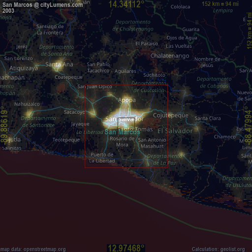
» NASA city lights 2003
» Earth at Night: Flat Maps 2012, 2016