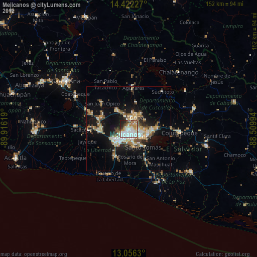
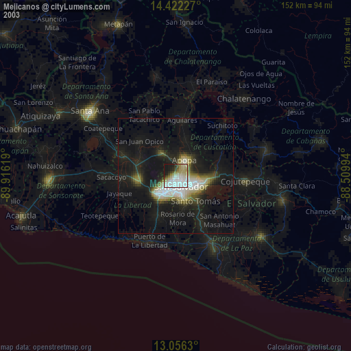
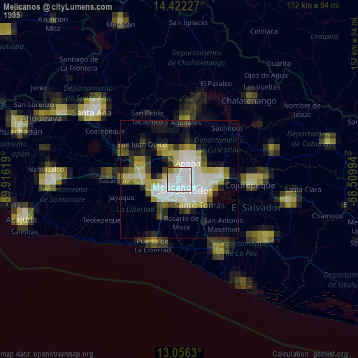
Mejicanos night lights from space
Night Light of Mejicanos (San Salvador) from space (El Salvador) Src. Average luminocity for 10x10km area is 67.688% and for 50x50km: 15.2588%.
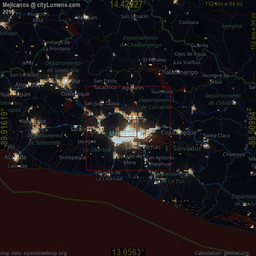
Analysis of Mejicanos night lights 2016
Square area 10x10 km:
 21.69%
90-99
21.9%80-89
3.51%70-79
3.93%60-69
5.37%50-59
8.26%40-49
8.26%30-39
8.68%20-29
14.26%10-19
4.13%0-9
0%Square area 50x50 km:
2.27%90-99
2.7%80-89
1.73%70-79
1.16%60-69
1.85%50-59
2.41%40-49
2.22%30-39
2.78%20-29
4.31%10-19
10.51%0-9
68.06%Clear (daylight) street map image can be seen on geolist.org.
Map coordinates:
14° 25' 20.2" North, 89° 54' 58.3" West
13° 44' 25" North, 89° 12' 47" West
13° 3' 22.7" North, 88° 30' 35.8" West
Some cities around Mejicanos sort by population:
• San Salvador
6.3 km =3.9 mi,  153°
153°
• Soyapango
8.6 km =5.3 mi,  112°
112°
• Apopa
8.3 km =5.2 mi,  26°
26°
• Delgado
5 km =3.1 mi, 111°
• San Marcos
9.6 km =6 mi,  160°
160°
• Cuscatancingo
3.5 km =2.2 mi,  97°
97°
• Antiguo Cuscatlán
9.4 km =5.8 mi,  207°
207°
• Ayutuxtepeque
0.9 km =0.6 mi,  50°
50°
3584399 (p: 160,317)
Sources (retrieved 2019-11-25):
» NASA, Earths city lights 1995
» NASA city lights 2003
» Earth at Night: Flat Maps 2012, 2016