Panchimalco night lights from space
Night Light of Panchimalco (San Salvador) from space (El Salvador) Src. Average luminocity for 10x10km area is 19.6818% and for 50x50km: 15.0257%.
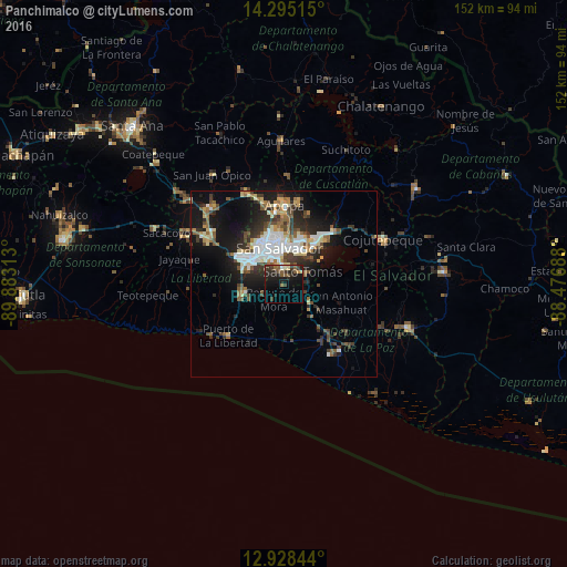
Analysis of Panchimalco night lights 2016
Square area 10x10 km:
 0.21%
0.21%90-99
1.24%80-89
3.1%70-79
0.83%60-69
1.65%50-59
6.4%40-49
2.48%30-39
6.4%20-29
11.57%10-19
19.63%0-9
46.49%Square area 50x50 km:
2.31%90-99
2.7%80-89
1.7%70-79
1.08%60-69
1.68%50-59
2.4%40-49
2.36%30-39
2.89%20-29
4.39%10-19
10.18%0-9
68.3%Clear (daylight) street map image can be seen on geolist.org.
Map coordinates:
14° 17' 42.5" North, 89° 52' 59.3" West
13° 36' 46" North, 89° 10' 48" West
12° 55' 42.4" North, 88° 28' 36.8" West
Some cities around Panchimalco sort by population:
• San Salvador
8.5 km =5.3 mi,  354°
354°
• Soyapango
11.7 km =7.3 mi,  21°
21°
• San Marcos
5.1 km =3.2 mi,  356°
356°
• Antiguo Cuscatlán
9.8 km =6.1 mi,  306°
306°
• Santo Tomás
5.9 km =3.7 mi,  58°
58°
• Nuevo Cuscatlán
10 km =6.2 mi,  293°
293°
• Olocuilta
8.3 km =5.2 mi,  125°
125°
• Rosario de Mora
5.2 km =3.2 mi,  216°
216°
3584156 (p: 6,764)
Sources (retrieved 2019-11-25):
» Earth at Night: Flat Maps 2012, 2016