Olocuilta night lights from space
Night Light of Olocuilta (La Paz) from space (El Salvador) Src. Average luminocity for 10x10km area is 6.3657% and for 50x50km: 12.6436%.
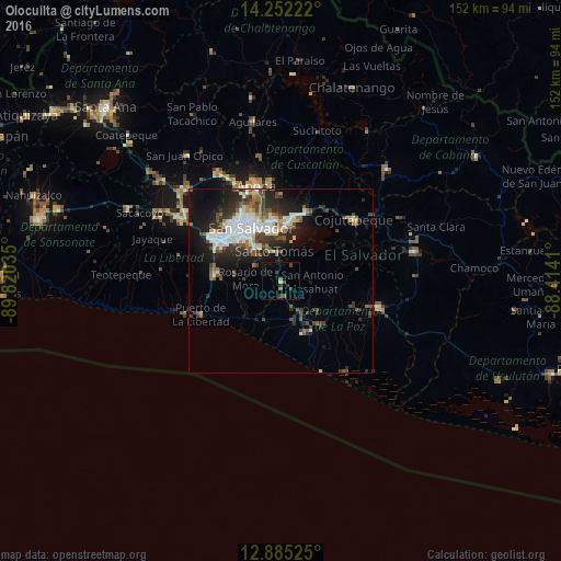
Analysis of Olocuilta night lights 2016
Square area 10x10 km:
 0%
0%90-99
0%80-89
0.83%70-79
0.21%60-69
1.86%50-59
0.41%40-49
2.07%30-39
2.07%20-29
2.48%10-19
0.83%0-9
89.26%Square area 50x50 km:
2.22%90-99
2.56%80-89
1.12%70-79
0.64%60-69
1.15%50-59
2.03%40-49
2.17%30-39
2.65%20-29
4.02%10-19
7.31%0-9
74.13%Clear (daylight) street map image can be seen on geolist.org.
Map coordinates:
14° 15' 8" North, 89° 49' 13.3" West
13° 34' 11" North, 89° 7' 2" West
12° 53' 6.9" North, 88° 24' 50.8" West
Some cities around Olocuilta sort by population:
• San Salvador
15.3 km =9.5 mi,  330°
330°
• Soyapango
15.8 km =9.8 mi,  351°
351°
• San Marcos
12.2 km =7.6 mi,  324°
324°
• Ilopango
14.7 km =9.1 mi,  3°
3°
• Santo Tomás
8.1 km =5 mi, 347°
• Panchimalco
8.3 km =5.2 mi,  305°
305°
• El Rosario
12.4 km =7.7 mi,  130°
130°
• Rosario de Mora
9.9 km =6.2 mi,  273°
273°
3584212 (p: 6,324)
Sources (retrieved 2019-11-25):
» Earth at Night: Flat Maps 2012, 2016