Ciudad Arce night lights from space
Night Light of Ciudad Arce (La Libertad) from space (El Salvador) Src. Average luminocity for 10x10km area is 9.6364% and for 50x50km: 10.6725%.
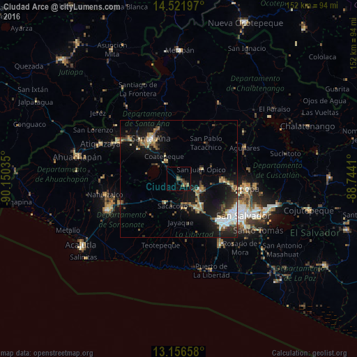
Analysis of Ciudad Arce night lights 2016
Square area 10x10 km:
 0%
0%90-99
0.41%80-89
0.41%70-79
0%60-69
2.69%50-59
3.93%40-49
1.65%30-39
4.13%20-29
1.24%10-19
5.17%0-9
80.37%Square area 50x50 km:
1.08%90-99
1.5%80-89
1.42%70-79
0.74%60-69
1.32%50-59
1.98%40-49
1.36%30-39
1.97%20-29
2.75%10-19
10.16%0-9
75.71%Clear (daylight) street map image can be seen on geolist.org.
Map coordinates:
14° 31' 19.1" North, 90° 9' 1.3" West
13° 50' 25" North, 89° 26' 50" West
13° 9' 23.7" North, 88° 44' 38.8" West
Some cities around Ciudad Arce sort by population:
• Santa Ana
21 km =13 mi,  324°
324°
• Santa Tecla
25.6 km =15.9 mi,  135°
135°
• Quezaltepeque
18.9 km =11.7 mi,  93°
93°
• Izalco
26.6 km =16.5 mi,  246°
246°
• Armenia
12.1 km =7.5 mi,  207°
207°
• El Congo
9.3 km =5.8 mi,  325°
325°
• San Juan Opico
10.3 km =6.4 mi,  67°
67°
• Coatepeque
11.6 km =7.2 mi, 327°
3586985 (p: 10,095)
Sources (retrieved 2019-11-25):
» Earth at Night: Flat Maps 2012, 2016